 |
| The Superstition Mountains - host for the Lost Dutchman gold mine. |
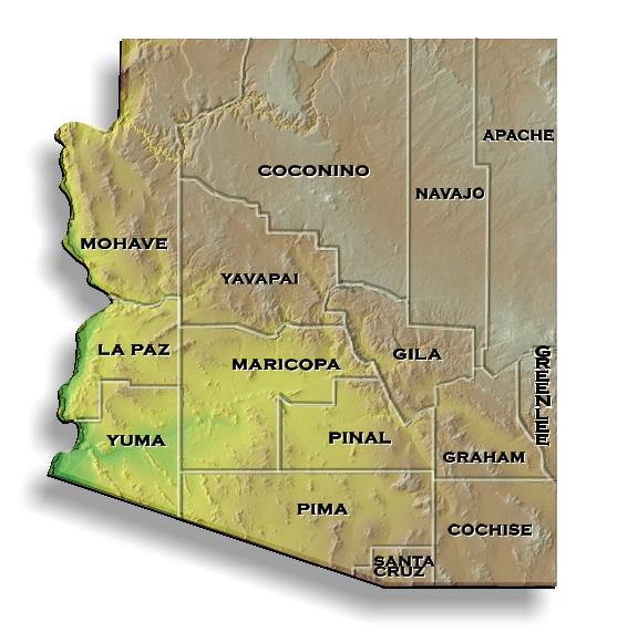
Geologists split Arizona into three provinces: (1) Basin and Range, (2) Transition zone, and (3) Colorado Plateau. The Basin and Range province in southern and western Arizona is geologically young and filled with alternating basins and ranges that extend from Nevada to western Utah and Arizona and continues east to southern New Mexico. Ranges are followed by basins and the sequence is repeated over and over and over – it's like paying taxes - it just never seems to end. The province is a result of a major head-on collision by tectonic plates that buckled the western US. In fact, geological evidence suggests the Pacific plate on the west collided with the North American plate resulting in fractures that propagated through the lower crust and providing conduits for volcanic eruptions throughout much of the province. Many mountain ranges popped up in between all of the basins. Everywhere one looks, they see evidence of past volcanic eruptions dating from the Tertiary to Recent time. Basalts, rhyolites, flows, plugs, dikes, ash falls, etc. Some even look like they erupted just last weekend.
 To the north, the Basin & Range gives way to the Transition Zone province – a mountainous highland that separates the Basin & Range from the Colorado Plateau to the north. This transition zone encloses the Mogollon Rim and the White Mountains of Arizona.
Further north, the Colorado Plateau represents a geologically stable province. While the Basin and Range suffered considerable folding, faulting and vulcanism; the Colorado Plateau had only minor deformation over the past 600 million years. The Plateau extends northward to the Rocky Mountain province and into the Wyoming Craton in Wyoming and Montana.
Gold deposits are often found where considerable fracturing, deformation, volcanism occurred. Thus areas of greatest potential for gold in Arizona are within the Basin and Range and Transition zone provinces (Hausel, 2010).
But, Arizonians suffer with hot summers and deserts that lack water needed for placer mining and lode mills, but it is still a wonderland for prospectors. If the heat isn't bad enough, there is the added concern of foreign drug runners, terrorists with automatic weapons entering the US along the Mexican border, and snowflakes from California. This is emphasized by a memorial to police officers killed by illegal immigrants.
.jpg) |
|
in finding gold (rated 4.5 stars by Amazon
customers).
|
Phoenix became a kidnapping capital with activity related to illegal immigrants, Mexican cartels, and human smugglers. Only Mexico City had a higher kidnapping rate. One source reported 83% of all warrants issued for murder in Phoenix and 95% of warrants issued in Los Angeles were for illegal immigrants. In a 2008 book on the Sierra Madre, Mexico, author Richard Grant wrote that the largest part of Mexico’s economy is based on selling and distribution of illegal drugs - imagine that!
As incredible as it sounds, the US government closed 3,500 acres of the Buenos Aries National Wildlife Refuge to American citizens because of “… safety concerns fueled by drug and human smuggling along the Arizona-Mexican border…” according to FoxNews.com - US Parkland Bordering Mexico. It has been closed to US citizens since 2006 even though it has considerable mineral potential.
Mineral Production
Arizona produces $6 to $8 billion in mineral wealth, annually. Much of which is mined from giant porphyry copper deposits where gold and silver is recovered as by-product of primary copper, zinc, lead, etc., during mining. For those unfamiliar with copper porphyries, these are root zones of ancient volcanoes that have distinct rocks that include multiple ‘granitic’ stocks (i.e., granodiorite, diorite, quartz monzonite) some of which have porphyritic texture. This texture is a rock fabric in which large crystals (such as feldspar and quartz) are dispersed throughout a finer grained matrix in an igneous rock as a result of slow cooling in a magma chamber at relatively shallow depth.
 |
| Underground at the Resolution mine, Superior, AZ |
 |
The author with friend Rich at
the Resolution shaft, Arizona |
When mineralized; porphyries can intrude reactive rocks such as limestone. This results in rich replacement deposits and skarns. Other types of mineralization include high-grade veins, low-grade cupriferous stockworks and low-grade disseminated copper and/or gold mineralization. These veins provide excellent targets for gold and silver. Some veins adjacent to the Kirwin (Bald Mountain) porphyry in Wyoming yielded channel samples with >50 ounces per ton (opt) silver and a some yielded samples that assayed >100 opt silver with minor gold (Hausel, 1997).
Arizona is an important source for copper (Cu), molybdenum (Mo), lead (Pb), zinc (Zn), gold (Au) and silver (Ag). In 2007-2008, miners extracted copper, molybdenum gold and silver at Morenci, Bagdad, Sierrita, Safford, Miami, Ray, Mission, Silver Bell, Pinto Valley, Mineral Park, Johnson Camp and Carlota. In addition, exploration continued at Resolution, Rosemont and elsewhere (Niemuth, 2008).
Gold deposits include eluvial placers, dry placers, stream placers, veins, faults and breccia pipes along with gold associated with porphyry copper, massive sulfides and replacement deposits. Total historical gold production from Arizona is about 16 million ounces since records were kept beginning in the late 19th century. The state could produce considerably more by providing exploration and mining incentives and by providing free prospecting education to the public (Hausel, 2011a, b).
Primary gold lodes include the Vulture mine, which produced 370,000 ounces of gold in the Wickenburg district north of Phoenix, the Oatman and Katherine camps which produced more than 2 million ounces of gold in the San Francisco district (NW Arizona) (Koschman and Bergendahl, 1968). Gold is found at Lost Basin and Chloride in western Arizona. Many gold properties are south of Tucson at Arivaca and Oro Blanco west of Bisbee. Gold is also found at Rich Hill-Weaver Mountains near the center of the state, the Big Bug district to the northeast of Rich Hill. Gold is described in several districts by Wilson and others (1969) and Wilson (1981).
Gold Placers
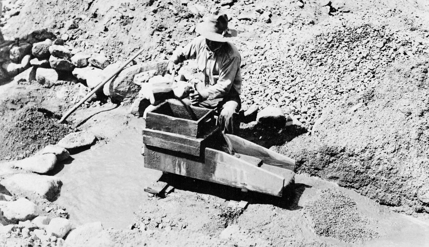
Gold placers occur in many counties in Arizona. Most are in fanglomerates associated with alluvial fans and pediments due to the arid environment. Similar to Australia, active stream placers are rare because of the lack of perennial streams. But at least we don't have any crocodiles.
.JPG) |
Mineralized copper, gold, silver breccia from a breccia pipe from
Arizona. This is rich ore! |
One of the few active stream placers is Lynx and related placers in the Bradshaw Mountains at the southern edge of Prescott. More than 108,000 ounces of gold were recovered from this placer since 1863. The placers are along the entire length of the creek. Gold occurs as fine flakes and nuggets up to 4 ounces (nuggets are gregarious and never occur alone). Portions of the placer were set aside for recreational gold panning by the city of Prescott and the US Forest Service. Nuggets up to 11 ounces were also found in the Copper Basin placers about 15 miles to the west. Another wet placer was found in 1853 near the confluence of the Gila with the Colorado Rivers in southwestern Arizona. The discovery attracted more than 1000 prospectors in 1861, but the gold reportedly played out. And placers were found in the Big Bug district including one that weighed more than 20 ounces.
Gold in dry placers in Arizona was supplied by erosion of lodes up-slope. Some productive dry placers include LaPaz, Dome, Gila City, LaCholla, Weaver, Rich Hill, Greaterville, Quijotoa, King Tut and White Hills (Wilson, 1981). Flash flooding in the past concentrated gold in pay streaks in these placers. Notable is Greaterville south of Tucson. These were rich, but water had to be transported up-slope to the dry placers over a distance of more than 4 miles.
At the LaPaz placer west of Quartzsite, gold was discovered in 1862 along the Dome Rock Mountains of western Arizona. Gold was recovered at Goodman Arroyo, LaPaz Arroyo, Ferrar Gulch, Garcia Gulch and Ravenna Gulch. The gold-bearing gravels ranged from a few feet to many feet thick and was distributed throughout the gravel and enriched on bedrock. The district became known for large nuggets that included 26, 27, 47 and 65 ounces. Such large nuggets indicate a nearby lode source.
Lode Gold
Rich silver lodes were discovered in the Bradshaw Mountains and at the Silver King, Signal, Globe, Tombstone and Pearce (Turquoise) districts. Silver mining was followed by copper discoveries, and then by the transcontinental railroads in 1881. Along with copper came gold (a by-product of many lode mines).
.JPG) Most primary lode gold deposits were found as auriferous quartz veins with limited strike length and width. However, other lodes, such as the Commonwealth at Pearce, Arizona, occurred as veins and groups of veinlets known as stockworks that contained considerable silver with gold. Other deposits, such as the Mexican Hat and Gold Coin to the south in the Turquoise district, were low-grade disseminated gold lode deposits similar to some mined in Nevada and Utah. More gold will be found and mined in Arizona!
Most primary lode gold deposits were found as auriferous quartz veins with limited strike length and width. However, other lodes, such as the Commonwealth at Pearce, Arizona, occurred as veins and groups of veinlets known as stockworks that contained considerable silver with gold. Other deposits, such as the Mexican Hat and Gold Coin to the south in the Turquoise district, were low-grade disseminated gold lode deposits similar to some mined in Nevada and Utah. More gold will be found and mined in Arizona!MINING DISTRICTS and MINERALIZED AREAS
Apache, Coconico and Navajo Counties
Driving from northwestern New Mexico along I-40 to Apache County Arizona cuts through the Fort Apache and the Navajo Indian Reservations, and passes through the Petrified Forest, Painted Desert and the Canyon de Chelly all part of the Colorado Plateau. Although this terrain produces extraordinary sandstone buttes and monuments of the Chinle and Navajo Formations, the geologically stable terrain is not conducive to gold. But has potential for sandstone-type reef and roll-front uranium deposits and breccia pipes. Wilson (1961) noted gold placers of economic importance are found in every county in Arizona except Apache, Coconico and Navajo Counties (the Colorado Plateau).
 |
Basalt with peridotite nodules from Arizona.
The peridotite has considerable gem-quality peridot andrepresents pieces of the earth's mantle plucked from depth and brought to the surface in the basalt. |
In the four corners region near the Red Rock Highway from Shiprock, New Mexico to Arizona, are volcanic rocks that form Ship Rock and other volcanic breccias. Ship Rock is a volcanic neck with radiating dikes (see Google Earth for Ship Rock). These volcanic rocks originate deep the earth’s mantle (much deeper than basalts and rhyolites).
Gemstones include pyrope garnet and peridot eroded from the Navajo Volcanic Field. The volcanics include serpentinized ultramafic rocks and breccias that have similarities to kimberlite (Hausel, 1998). In the past, many researchers even described these as kimberlites, but they are now referred to as lamprophyres known as minette (Hausel, 1998; Erlich and Hausel, 2000). Even so, a few minettes around the world contain diamond. Whether or not these have any diamonds is unknown. Garnets are mined by local Indians for gems and by ants for ballast for anthills. The ants drag the gems to their hills and provide a great concentrating process.
In 1871 and 1872, two enterprising prospectors from San Francisco decided to ‘salt’ an area in northern Colorado with diamonds and other gems in what we now refer to as the Great Diamond Hoax. Other gems included ruby and garnet. The diamonds were from the South African diamond fields, which had just been discovered and the garnets were pyrope and pyrope-almandine garnets collected from Arizona anthills. These were placed over a flat sandstone outcrop along the northern base of what is now referred to as Diamond Peak in Colorado (Hausel and Stahl, 1995) (40o57’01”N; 108o52’41”W). What is amazing about this scam was that the perpetrators did not realize pyrope garnet was a pathfinder mineral for diamond deposits. All they understood was garnet was the color of ruby and they were under the impression they were salting the outcrop with rubies and diamonds. Even more amazing was that the area they chose in northern Colorado sits 50 miles south of the Leucite Hills lamproites, 60 miles east-southeast of the Butcherknife Draw anthill garnets and chromian diopside (which tends to look like emeralds), 60 miles east of the Cedar Mountain diamondiferous lamprophyres, and 175 miles west of the diamondiferous kimberlites in the Colorado-Wyoming State line district. There are even reports that the Bishop Conglomerate at the top of Diamond Peak has pyrope garnets and chromian diopside (both pathfinder minerals for diamond) (McCandless and others, 1995).
In the Painted Desert, a region embracing a large geographic area of the Chinle Group (Triassic) of rocks, microscopic particles of gold are reportedly disseminated in residual clays. There are reports of prospectors recovering some gold from this formation near Show Low.
Ajo district
Gold was recovered as a by-product of copper mining at Ajo, south of Gila Bend and 75 miles south of Phoenix. Copper was initially recovered on a small-scale in 1750 AD by Spaniards and later by open pit at the New Cornelia mine in northwestern Pima County. By 1917, New Cornelia was developed into Arizona’s first open pit mine. Total by-product gold mined through 1959 was 1 million ounces with the 6.3 billion pounds of copper. Operations ended in 1983. But like most mines, the deposit was never mined out.
The Ajo ore body is elliptical (6,400 feet long by 3,900 feet wide and 1,560 feet deep). It consists of veinlets and disseminated chalcopyrite, bornite and minor pyrite. The upper part of the porphyry was oxidized with copper carbonate and silicate and minor chalcocite in fractured and faulted Laramide-age quartz monzonite and quartz diorite. Mineralization extended into the intruded Cretaceous volcanics and was controlled by fracturing and rock permeability and associated with fractures, veins and breccia. Rock alteration includes sericitic, chloritization, kaolinization, silicification with oxidation down to water table (Joralemon, 1914). Gold is closely associated with copper sulfide rather than pyrite.
The ore body was mined to a depth of 750 feet and total production from 1917 through 1972 amounted to 350 million tons of ore averaging 0.8% Cu, 0.05 opt Ag and 0.004 opt Au with some zinc (Zn) and lead (Pb)(Singer and others, 2008). Some copper minerals were gem quality and used for jewelry (ajorite, shattuckite and turquoise).
Ash Peak District
Gold (Au) and silver (Ag) was discovered in the Ash Peak district in 1900 with production from 1905 to 1970. Mineralization is described as tabular and narrow brecciated siliceous silver-gold ore in a vein complex nearly 2 miles long and 20 feet wide. The structure strikes N60oW and dips 80oNE in host Tertiary diabase, rhyolite and basalt. At least three parallel veins were recognized in the district with Ag-Au-Cu-Pb-Mn-silica ore shoots of fairly consistent grade. One assay reported 10.97 opt Ag and 0.025 opt Au.
The mineralized veins are in the SE¼ sec. 3, the NW¼ sec. 11, and in sections 2 and 10, T8S, R30E about 0.75 miles northeast of Ash Peak, 0.5 miles south of Highway 70 and 8-miles W-NW of Duncan. The Shamrock shaft was the main shaft on the Ask Peak claims.
Mines included the Commonwealth shaft; the Hardy shaft (700 feet deep); the Shamrock shaft (1000 feet deep) and the Commerce shaft (500 feet deep). An open pit extends southeast from the Commerce. Lateral cross-cuts were driven every 100 feet in the Shamrock along with 11,000 feet of drifting. Drilling occurred to depths of 1400 feet. Two mills were constructed and the mineralization became a source for siliceous fluxing ore for nearby copper smelters.
Bagdad district
Bagdad is 80 miles northwest of Phoenix. The mine is an important source for copper, silver, gold, lead, zinc, molybdenum, titanium and rhenium. Copper was discovered in 1882 and production began in 1906 from a shaft sunk to 465-feet deep. Operations were later converted to open pit. In 2007, the operation yielded 202-million-pounds of copper and 10-million-pounds of molybdenum. The mine is being upgraded to extract larger amounts of molybdenum along with rhenium, a rare metal used in jet engine construction because of extremely high melting point. The operation also produced >300,000 ounces of silver with minor gold.
Bagdad is classified as porphyry copper with a blanket ore-body in the Brindle Formation. The ore is controlled by intersecting and closely spaced faults which increased permeability. Ore concentration was both hypogene and supergene. Alteration included sericitization and argillization.
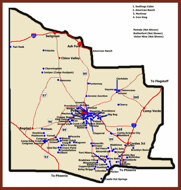
Big Bug District, Bradshaw Mountains
Southeast of Prescott, is one of many mining districts in the Bradshaw Mountains near Highway 69. The Big Bug district is primarily a massive sulfide district with both base and precious metals. The district lies along the northeastern slope of the Bradshaw Mountains near Poland Junction adjacent to Highway 69. Many deposits have rhyolitic host rocks and pyritic, cellular and scintery rocks typical of submarine hot springs and volcanic vents that were deposited in the past. Similar rocks are well-preserved at the world-class United Verde mine in Jerome. In addition to gold and silver, many Big Bug deposits have significant zinc, copper and lead. A few have significant amounts of gold - such as the Iron King and McCabe mines. These mines be found with Google Earth aerial photography and Topozone maps. In my upcoming book on Gold in Arizona, I provide GPS coordinates to all of these and other mineral deposits.
The district is underlain by Yavapai Schist intruded by diorite, granodiorite, granite and rhyolite-porphyry dikes. Mines and prospects include Big Pine, Binghampton, Butternut, Cash, Copper Queen, Davis-Dunkirk, Eugene, Gladstone, Golden Eagle, Henrietta, Hackberry, Iron King, Jersey Lily, Lelan-Dividend, Little Egypt, Little Jessie, McCabe, Money Metals, New Era, Poland-Walker, Ruth, Senator, Tillie Starbuck, Trapshooter-Reilly and Union. It is notable that several mines in this district exhibit similarities to the United Verde massive sulfide deposit at Jerome. In addition to volcanogenic massive sulfides, some replacement, vein and placer gold is found.
From 1901 to 1931, Wilson and others (1967) report significant copper, gold, silver, lead and zinc were mined including 200,000 ounces of gold of which 1,500 ounces were recovered from stream placers. Later, more gold was produced at the Iron King, where total production was 617,746 ounces of gold, 18,529,982 ounces of silver, 125,375 tons of lead, 367,569 tons of zinc, and 9,553 tons of copper, making this one of the largest gold mines in Arizona.
One important mineralized horizon occurs along the eastern edge of the district. This horizon is recognized by meta-rhyolites outcropping on the west, and metamorphosed mafic flows on the east. The Lone Pine, Boggs, Iron Queen, and Upshot mines are in this mineralized horizon. A facies change from proximal at the Lone Pine mine to distal facies massive sulfide at the Upshot in evident.
Proximal facies are interpreted to also occur at the Pentland and Hackberry mines. The Pentland shows both proximal and distal characteristics, and the Hackberry mine has rhyolite inbetween the Pentland and Upshot zones. This rhyolite may be the same as that at the Pentland, but occurs in the opposite limb of an antiform. The Butternut mine is found on a limb of a major synform opposite to the limb that hosts the Iron King mine. Both the Iron King and Butternut have distal characteristics.
Placer gold was discovered in the Big Bug district in the l860s, and considerable sluicing, rocking, and panning occurred during the 1880s in upper Big Bug Creek extending south to Mayer. Gold was also found in Chaparral and other gulches near the McCabe ghost town (34°29'23"N; 112°17’16"W). And some dry-washing was employed in drier regions.
Placer gold is found in stream channels and intervening mesas in an area about 20 miles east and northeast of the head of Big Bug Creek. The gold is coarse: one of the larger nuggets weighed 24.2 ounces. However, gold on mesas between Dewey-Humboldt and Mayer, is finely divided and associated with clay in the gravel. This pediment also extends up local gulches (Wilson, 1981).
Total placer gold recovered in 1934 amounted to 428 ounces. In 1940, the Big Bug Dredging Company operated a dragline on the Hill property and recovered 1,100 ounces of placer gold. Small-scale placer operations were active during 1932-33 when a few dozen prospectors worked gravel benches and side gulches of Big Bug Creek northwest of Mayer. Some operations dug tunnels in gravel before processing the material. Many were handicapped by a large number of coarse boulders.
The recorded gold production from the Big Bug placers amounted to 1,488 ounces for 1910-31 and 13,214 ounces for 1934-39 (Wilson, 1981). Topographic maps in the area show dredge tailings at a number of placers along Big Bug Creek including (1) 34°26'38"N; 112°16’22”W, (2) 34°26'0"N; 112°16’7”W; (3) 34°26'3"N; 112°16’4”W; (4) 34°25'40"N; 112°15’50”W; and (5) 34°25'4"N; 112°15’14”W [If you are trying to figure out what to do with these numbers, just plot them on Google Earth and then examine maps at Topozone. This will take you right to the deposit.
Bisbee (Warren) District
.JPG) |
| Lavender open pit mine at Bisbee, Arizona |
Copper was discovered in 1877 at Bisbee in the Mule Mountains of southern Arizona with by-product gold, silver, lead and zinc in massive sulfide and replacement deposits. Open pit operations began at the Copper Queen and Lavender mines on Sacramento Hill and shafts sunk to access higher grade ore at depth. More than 8 billion pounds of copper, 2.9 million ounces of gold, 100-million ounces of silver, 305 million pounds of lead and 372 million pounds of zinc and 35,000 tons of manganese ore and some turquoise were recovered prior to termination of operations in 1977. These metals were valued at more than $6.1 billion (1975 prices).
Mineralization occurred as high-grade copper carbonate with minor lead and zinc in irregular replacement deposits in the Martin Limestone (Devonian). Some ore was also found in the Escabrosa and Naco limestones. The ore was controlled by dikes, sills, faulting and associated brecciation. Much ore occurred as bornite replacing pyrite. Some malachite and turquoise was used as gems (Bryant and Metz, 1966).
The Campbell ore body sits adjacent to the Lavender pit. This was largely an oxidized copper deposit with minor lead and zinc as irregular replacements in the Abrigo (Cambrian), Martin (Devonian) and Escabrosa (Mississippian) limestones in association with porphyry dikes and sills and mined underground. The ore body was formed primarily of chalcopyrite with masses of bornite and chalcocite with increasing amounts of sphalerite and galena near the margins.
 |
| Chalcopyrite specimen collected at the Ferris-Haggarty mine, Wyoming - similar to chalcopyrite mined at Bisbee, Arizona. (Photo by Dan Hausel, the GemHunter). |
The district is in the Mule Mountains. East of the Mule mountains is a broad Tertiary valley floor (Sulphur Springs Valley) that extends across 20 miles of valley fill before rising to the Pedregosa Mountains. West of the Mule Mountains, the San Pedro Valley extends 15 miles to the Huachuca Mountains with Miller Peak Wilderness.
We often forget that under valley fill are similar rocks to those in the mountain ranges. Thus what lies beneath these valleys are likely hidden ore deposits. Even under the open pit at Bisbee, there are likely undiscovered deposits. For the prospector, one of the better places to search for minerals is known mining districts because of the rock exposures and because miners often miss some ore deposits.
Highway 80 cuts the Mule Mountains continuing south from Tombstone. The Mule Mountains consist of Mesozoic rocks north of the highway that trend northwesterly with moderate northeast dips. The terrain is rough and difficult to negotiate with slopes descending into canyons. To the south, Paleozoic and older rocks are relatively resistant to erosion and have complicated structure. Rock formations in the Warren district include crystalline Pinal mica schist of Precambrian age that are unconformably overlain by Paleozoic rocks. The Paleozoics include the basal Bolsa Quartzite (Cambrian) overlain by more than 4500 feet of limestone that includes the Abrigo Limestone (Cambrian), Martin and Mural Limestones (Devonian) and Escabrosa and Naco Limestones (Carboniferous). During the Mesozoic, these rocks were deformed by faulting and folding and intruded by granite. The principle episode of mineralization occurred during the early Cretaceous.
According to Francaviglia (1982), the main ore body at Bisbee was found where the Sacramento stock intruded metamorphic rock and limestone. Lead-silver ores were discovered in the vicinity of what is known as Hendricks Gulch along the west flank of Queen Hill in 1877. The ore occurred as irregular lead-carbonate masses replacing limestone along a fault. The ore was hosted by Martin Limestone near siliceous ore which cropped out as silica breccia stained by manganese. The siliceous ore was porous due to oxidation and leaching. Enriched deposits of gold was found in the siliceous ore where it had been mechanically and chemically concentrated (Trischka, 1938). The presence of gold suggests possibilities for limited placer gold in Hendricks, Uncle Sam and Silver Bear Gulches south of Bisbee near Queen Hill!
 |
| A beautiful example of cupriferous gossan. This material is oxidized from chalcopyrite. Through time, primary chalcopyrite ore oxidized and was replaced by azurite (blue) and limonite and goethite (yellow-brown rust). Chalcopyrite often has some gold in its crystal structure, and the gold remains in the specimen (photo by the author). |
By 1881, operations recovered copper with by-product gold, silver, lead and zinc in massive sulfide and replacement deposits. The metals were recovered near the surface and at depth from underground operations at the Denn, Campbell, Calumet and other shafts and from open pit operations at the Copper Queen and Lavender pits. Some of this ore averaged an incredible 23% copper. Ore minerals included native copper, chalcopyrite, sphalerite, cuprite, azurite, malachite, brochantite, tenorite, aurichalcite with minor turquoise.
If you search for “Bisbee, AZ” on Google Earth or Virtual Earth you should have a Birdseye view of the open pit mine and a noticeable rusty (red to yellow) gossan (altered and oxidized zone) can be seen on the eastern edge of Bisbee at Red Hill. The gossan lies along the northern edge of the Queen and Lavender open pit mines. I wonder what lies beneath this gossan?
.jpg) |
Geophysicists searched with a magnetometer and detected, magnetic anomalies consistent with a buried porphyry deposit in the Bisbee region. Similar anomalies identified near Lordsburg New Mexico resulted in discovery of a hidden porphyry copper deposit. Thus possibilities for finding additional ore at Bisbee are high.
Small gold placers were found 4 miles southeast of Bisbee at Gold Gulch (31o23’54”N; 109o51’28”W). The gold was eroded from the Glance conglomerate (Cretaceous) and concentrated in sand in the arroyo. In 1933, it was reported a group of miners working the gulch recovered gravel that averaged about 0.008 ounces/cubic yard of gold. Overall, about 247 ounces of placer gold was recovered in 1934 and only 25 ounces from 1935-41. It is likely there is still placer gold in the district, but potential is limited due to lack of perennial streams.
Lead ore was initially reported in Hendricks Gulch (SW section 9, T23S, R24E). This ore was smelted at a spring near the present main street of Bisbee. Some oxidized lead ore was used as flux at the Charleston smelter and lead was also mined in Uncle Sam Gulch in the NE corner of section 17 in 1908.
Zinc was mined in 1917 and the Calumet and Arizona Mining Company shipped lead-zinc ore to paint manufacturers in Kansas. Shipment of zinc to smelters began in 1922. In 1927 Phelps Dodge constructed a flotation plant to treat low-grade lead ore at the Douglas smelter about 20 miles east-southeast of Bisbee. The smelter closed in 1930. In 1939 zinc-lead ore was mined in the eastern part of the Warren district and some ore was processed at the Shattuck-Denn custom mill at Bisbee and some was processed at the Eagle-Picher mill at Sahuarita south of Tucson until 1945, when Phelps Dodge completed its zinc-lead concentrator. Lead and zinc have also been found in the western portion of the district.
Black Rock (Castle Rock, Blue Tank) District, Wickenburg Mountains
The Black Rock district (34°3'5"N; 112°34'53"W) in the Wickenburg Mountains west of the Bradshaw Mountains and north of Peoria Arizona, is in the southern part of Yavapai County of the Central Mountain Region province. This district produced 9,700 ounces of gold, 110,000 ounces of silver, 400,000 pounds of copper, and 444,000 pounds of lead between 1902 to 1967 (Keith and others, 1983). Some average ore grades were reported as 0.26 opt Au, 2.28 opt Ag, 0.61% Cu and 0.10 % Pb (Arizona Geological Survey Open file report 85-12).
The district is underlain by granitic gneiss (1.73 Ga) (Proterozoic) intruded into northwest-trending belts of Yavapai schist. This basement is overlain by intermediate to mafic volcanics (Tertiary) with areas of unconsolidated silt, sand and gravel (Quaternary). The Laramide (68.4 Ma) Wickenburg granodiorite batholith crops out to the southwest (Nichols, 1983).
According to the Arizona Bureau of Geology and Mineral Technology (1985), the district consists of Precambrian amphibolite-grade metaigneous rock, granite gneiss, and granite. Northwest-striking Miocene rhyolite porphyry and mafic dikes cross-cut the east-northeast-striking fabric of the Precambrian rocks. The mafic (andesite?) dikes are locally altered and cross-cut by epithermal quartz-pyrite-siderite-fluorite veins, some that have chalcopyrite, galena, arsenopyrite and tetrahedrite. Secondary specularite and chrysocolla occur locally in the northwest-striking high-angle quartz-sulfide veins.
The Monte Cristo mine (34°3'54"N; 112°34'59"W) is reported to have some nickel-cobalt arsenates and sulfides along with gold and silver. In contrast, the Grijalva and Oro Grande (34°1'39"N; 112°43'22"W) mines are characterized by pyritic copper-gold ores in thick, high-angle, northeast-striking quartz veins. The latter two vein deposits may have been rotated during middle Tertiary faulting.
The majority of the Black Rock district ore bodies have northwest trends and, therefore, appear to be associated with mid-Tertiary listric normal faults that rotate Precambrian basement and the Tertiary volcanic cover in the Wickenberg area. The distinctly different trend and character of the Grijalva and Oro Grande mines suggests a Laramide age for these latter deposits.
Black Canyon District
The Black Canyon district covers an area about 18 miles long by 8 miles wide from the eastern foothills of the Bradshaw Mountains to the Agua Fria River. This area runs from the vicinity of Cordes to the north to the Maricopa County border to the south and both lode and placer gold are found in the region.
The district is underlain by north-trending belt of metasedimentary Yavapai schist (about 2 miles wide) that is intruded on the east and west by Bradshaw Granite and on the east by a northward-trending diorite. The Yavapai rocks floor a former valley and hilly pediment that is covered on the east by a mesa formed of volcanic rocks that has been deeply dissected by the southward-flowing, meandering drainage system of Black Canyon River and Aqua Fria River. The district is at elevations from 2,000 to 4,000 feet above sea level.
Gold-bearing veins are of two classes: (1) Precambrian quartz veins, mainly in the vicinity of Bumblebee and Bland Hill areas; and (2) quartz veins which dip at low angles and appear to be genetically connected with younger dikes of rhyolite-porphyry. According to figures compiled by the U. S. Geological Survey, the Black Canyon district produced some gold, silver, lead, and copper. About 3,341 ounces of gold were recovered from the district.
The Precambrian veins, according to Lindgren, are formed of glassy quartz containing some free gold and sulfides. As they erode, the provide gold to placers in the district. Lindgren mentions the Cleator property at Turkey Creek, Nigger Brown, Blanchiana, and Gillespie mines south of Bumblebee, as having been worked in a small way. Placers occur along Black Canyon, which upstream branches into Turkey, Poland, Bumblebee, and other creeks and drains southward into the Agua Fria River.
Chloride district
The Chloride mining camp was founded in the early 1870's and named from the character of its rich silver ore. Ores rich in gold and silver were mined in the 1870's, but activity declined with the collapse of the silver price in 1882. Base-metal ores below the oxidized zone were not mined extensively until the completion of a railroad from Kingman to Chloride in 1899. Thereafter, lead-silver ores were mined and subsequent improvement in milling led to exploitation of complex lead-zinc ores. Zinc-lead mining reached a peak from 1915 through 1917 owing to high metal prices during World War I. Production declined abruptly after 1917, and thereafter mining was confined to veins with relatively high gold content. Gold production increased in 1935 and reached a peak in 1937-38. From 1950 through 1956 gold production was more than 100 ounces annually. From 1904 through 1956 the district produced 125,000 ounces of gold.
Christmas district (a.k.a Banner district), Gila & Pinal counties
The Banner district (a.k.a. Saddle Mountain district & Christmas district) lies within the Dripping Springs Mountains in southern Gila County of southeastern Arizona. The Dripping Springs Mountains form a northwest-trending Laramide uplift. The district extends south to northern Pinal County and for this discussion continues further south to the Saddle Mountain area. The district is 85 miles southeast of Phoenix and 20 to 25 miles southeast of Superior. It is accessed by way of Highway 177 southwest of Superior. The principal communities in the area include Winkelman, a town of about 260, and Hayden, a town of about 650. At Winkelman, route 177 intersects route 77 which continues further south as well as to the northeast around the southern tip of the Dripping Springs Mountains at the border of Gila and Pinal counties.
The basement rock of the district is formed by Pinal Schist (Proterozoic). These ancient rocks are overlain by a thick succession of Cambrian, Devonian and Carboniferous sedimentary beds which are in turn overlain by Cretaceous volcanic rocks and sedimentary rock intruded by rhyolite and diorite (Tertiary) dikes. The district includes more than 30 mines with mineralization associated with the intrusion of quartz-mica diorite dikes (andesitic) during the Tertiary. The deposits include (1) lead-silver veins, (2) pyritic gold deposits in shear zones, (3) disseminated pyrite deposits and (4) contact-metamorphic deposits. The latter have been mined for copper, lead, zinc, gold, silver and vanadium (Ross, 1925).
Extensive jasperoid-barite reefs and cross-cutting manganese oxide and carbonate veins with localized bedding replacement deposits are described near Kelly Springs in the vicinity of the NW section 19, T4S, R15E. These deposits exhibit colloform banding, open vugs and mercury-antimony anomalies that favor the hot spring deposition of the jasper. About 0.25 mile northeast of Kelly Springs are prospects with oxidize galena, sphalerite, smithsonite and minor copper carbonate and silver concentrations as high as 1,100 ppm (about 33 opt Ag) detected in a sample of lead-rich rock from a prospect dump (33°7'20"N; 110°49’37”W) (Banks and Krieger, 1977).
Many deposits in the district had been worked intermittently since the 1870's, but little ore was shipped prior to 1900 (Ross, 1925, p. 29). The Christmas mine (33°3'28"N; 110°44’40"W), discovered in 1880, was operated intermittently through 1954 and was the principal mine in the district. A much more productive mine is locates to the northwest a Ray along the western flank of the Dripping Springs Mountains. Within the district, the nearby 79 mine has extensive workings dug in a well-developed primary ore zone, overlain by an oxidized ore modified by supergene enrichment. The 79 Mine became a popular site for mineral collectors: at least 74 different minerals were recovered from the mine in the past.
Total gold production from the district from 1905 through 1959 included 26,000 ounces of gold. In addition, 550,000 tons of copper ore, 6,500 tons of lead-silver ore and a minor amount of zinc was shipped from the district along with minor of vanadium.
South of the border in Pinal County, pyritic-gold veins were identified in the lower part of Ash Creek and at the Hoosier prospects, the Two Queens and Pool mines. Similar veins were also described at the Hogvall prospect and Mellor prospect near Christmas. These type of deposits occur in shear zones and have northeasterly strikes and dip steeply. They are hosted primarily by Cretaceous hosts as well as the Martin and Naco (Tornado) limestones. The mineralized zones are sheared and brecciated and contain secondary quartz, chlorite, sericite and calcite. Pyrite and chalcopyrite may be present. Where these rocks are oxidized, they can be crushed and panned for metallic gold. Some of the oxidized ore is reported to assay 0.14 opt to 0.43 opt Au.
In places, disseminated pyrite was found in basalt and dark colored andesite such as at Gaull, Little Gold Gulch, and near the old Christmas workings. Some rock in Little Gold Gulch is reticulated with quartz veinlets. On the east side of the gulch are shear zones.
Contact metamorphic deposits are primarily found as replacement deposits in limestone. Most of these have secondary garnet with other characteristic contact metamorphic minerals. Such deposits are found at the Christmas mine, the London-Arizona property, the Schneider group and the Gold-Copper, Seventy-nine, Apex and Columbia mines. These types of deposits are recorded in the Naco, Abriosa and Martin limestones, the Troy quartzite, and in the Mescal limestone and in diabase. They all lie near quartz-mica diorite dikes.
Lead-silver veins with quartz, barite and calcite gangue include galena and other sulfide minerals. These types of deposits are primarily in the Saddle Mountain district north of Old Mill between Ash Creek and Deer Creek. Many of these occur at the Adjust, Saddle Mountain and Little Treasure properties. The veins are located primarily in andesite and may be a few inches to 2 feet thick. Some of these veins are outlined by slight vegetation anomalies having a greater density of bushes
The mineralogy of the replacement deposits include quartz, andradite garnet, vesuvianite, wollastonite, epidote, pargasite, chlorite, fluorite, chalcedony, magnetite, specularite, chalcopyrite, pyrite, sphalerite, galena and bornite. Where oxidized, these deposits may also have chrysocolla, azurite, native copper, gold manganese, limonite, cerusite, anglesite, plumbojarosite, wulfenite, gypsum and alunite. Vanadinite has been found associated with wulfenite and three locations in the district. Supergene ore may include some covellite and chalcocite.
Some mines produced gold including the Lavell mines (location unknown) which produced about $10,000 in gold, the Apex mine produced about $20,000 in gold from oxidized lead ore and some high-grade gold ore (Banks and Krieger, 1977).
The Christmas mine and mill was developed at the southeastern margin of Dripping Springs Mountains. The property was staked on Christmas day in 1902 and developed into a surface and underground operation. The Christmas was formerly a surface and underground Cu-Au-Ag-Mo-Bi-Pb-Zn-Be-W and garnet abrasive mine. The deposit was discovered in 1880, mining began in 1905, and operations terminated in 1982. Workings terminated at the 908-foot level even though mineralization continues deeper. The ore body was located in a series of gently dipping limestones (Paleozoic) overlain by volcanics (Cretaceous) intruded by quartz diorite.
Mineralization was classified as contact metamorphic and replacement and was found over a surface area of 4,900 by 2,600 feet and to a depth of 2,100 feet. The ore was controlled by limestone-diorite contacts, favorable limestone beds and garnet-rich zones and fractures. Some garnet was mined for abrasives, but there are no reports of gem material. However, it is possible miners overlooked gem potential. Past production focused on the Naco and Escabrosa Limestones where the ore was confined to 11 distinct beds that were consistently mineralized constituting a 425-feet thick mineralized zone. More than 55 million pounds of copper, 300,000 ounces of silver, and 26,000 ounces of gold were recovered from 1905 to 1943. The ore had an average grade of 0.005 opt Au, 0.23 opt Ag and 2.04% Cu. At least three new minerals were identified at the mine – apachite (hydrated copper-silicate), junitoite (a hydrated calcium-zinc silicate) and ruizite (hydrated calcium-manganese silicate).
Workings continued to the 908-foot level and mineralization to greater depths. The property included 5 shafts and an open pit that operated until closure in 1982. The Christmas fault cuts limestone, lavas, and the quartz diorite intrusive along a NW-trend.
Hydrothermal alteration included epidotization, silicification, propylitic, K-silicate, quartz-sericite-chlorite, oxidation and carbonatization. The deposit has a pyrite-chalcopyrite core, chalcopyrite-bornite intermediate zone, and pyrrhotite-sphalerite-chalcopyrite margin.
Copper Creek (Bunker Hill) district
The Copper Creek district is east of the Mammoth mine and San Manuel and 50 miles northeast of Tucson in southeastern Arizona and is part of the Bunker Hill district that includes mineralization at San Manuel, Sombrero Butte and Copper Creek. Much exploration activity has occurred north of Sombrero Butte. It was initially explored in 1903. Along the western margin of the district, gold was recovered at the Mammoth-Tiger mine and copper was recovered from the San Manuel open pit from 1953 to 2003.
In 1995, mineralized breccia pipes and associated deposits were discovered in the Giluro Mountains with an estimated 3 billion pounds of copper. Other companies explored the district intersecting significant resources in breccia pipes and porphyries. The district is known to have more than 500 mineralized breccia pipes along with buried copper porphyry stockworks and distal lead-silver veins. The breccia pipes are confined to the Copper Creek granodiorite and Glory Hole volcanics. Redhawk reported the following drilled resources.
Measured and Inferred Resources
Deposit Millions Tons Cu (%) Mo (%) Au (opt) Ag (opt)
Mammoth breccia 3.5 1.47 0.003 0.002 0.2
Childs-Aldwinkle 1.45 1.88 0.062 0.006 0.23
Old Reliable 1.13 1.21 0.012 0.003 0.09
Keel porphyry 0.25 1.19 0.032 0.004 0.08
Inferred Resources
Mammoth breccia 0.334 1.59 0.003 0.000 0.02
Childs-Aldwinkle 0.62 2.01 0.043 0.005 0.18
Old Reliable 0.327 1.33 0.013 0.001 0.03
Keel porphyry 2.29 1.22 0.041 0.009 0.08
The breccia pipes are include high-grade cupriferous pipes or chimneys thought to be associated with underlying copper porphyry systems. Such pipes are circular to oval shape in plan and have higher grade mineralization along the outer edges in the highly fractured ring structures that surround the pipes. In the southern portion of the district, exploration of breccia pipes at Sombrero Butte identified more than a dozen pipes.
The district is underlain by Cretaceous sedimentary rocks that lie on Precambrian basement rocks. These are overlain by volcanic tuffs and flows and intruded by granitic to dioritic intrusives. The Copper Creek granodiorite intrudes Cretaceous rocks and is the main host for the breccia pipes and related porphyries. The Copper Creek, Childs-Aldwinkle, American Eagle and Sombrero Butte breccia pipes occur within three parallel belts that trend N30oW.
Copper Mountain (Clifton-Morenci) district
Located in southeastern Arizona west of New Mexico near the town of Clifton, the Copper Mountain district encloses a giant porphyry copper deposit with by-product gold and silver. Total by-product gold mined from 1882 through 1959 was 228,000 ounces and a small amount of gold was also recovered from silver ore at nearby Ash Peak to the south.
Copper was discovered at Morenci in 1872, but development was hampered by lack of transportation. The completion of the Southern Pacific Railroad in 1881 lowered transportation costs sufficiently to permit large-scale mining. The discovery in 1893 of large low-grade copper ores at Copper Mountain at Morenci assured a certain degree of stability in the district. Ore from Morenci also yielded some molybdenum, silver, lead and zinc. The deposit also contains minor rare earths, uranium, gemstones and garnet. Mineralization was accompanied by hydrothermal alteration that included zones of kaolinization, sericitization, calc-silicate hornfels and skarn.
The district is zoned with a chalcopyrite-rich core surrounded by a pyrite envelope which is surrounded by protore. Silver and gold are more abundant in less altered areas. The greatest molybdenum concentrations were in granite porphyry and turquoise was found in the oxidized portion of the deposit. Massive andradite garnet also occurs in skarn at the southwest corner of the open pit mine.
Copperstone
 |
| Detachment fault above mine adit. |
Copperstone is an open pit gold-silver-barite mine in the NE/4 section 12, T6N, R20W of western Arizona. The ore occurs as a tabular deposit with a strike of N30oW and dip of 30oNE. Ore is controlled by brecciation and detachment faults. Wallrocks exhibit both sericitic and chloritic alteration. Mineralization is associated with a detachment fault separating underlying metamorphosed volcanic rocks (Jurassic) from overlying sedimentary breccias. The presence of quartz, hematite, and chrysocolla are indicators of gold mineralization. The gold occurs in breccia above a listric fault, in quartz latite below the fault and in basalt plugs (the plugs are the least mineralized). The listric fault is in the upper plate of a detachment fault. The mineralized contact zone extends horizontally for 3,000 feet and at least 1,000 feet down dip and is generally several tens of feet thick.
Proven and probable reserves drilled on the property include 911,367 tonnes of ore at average grades 8.75 grams per tonne (256,430 ounces of gold) or about 0.3 opt Au. The reserves are based on a cutoff grade of 4.5 grams of gold with the highest reported assay at 171 grams (6 ounces/tonne). Measured and indicated resources include 941,357 tonnes grading 10.35 grams per ton (313,183 ounces of gold) with an additional inferred resource of 369,000 tonnes at 12.21 grams per ton (144,892 ounces of gold) (Northern Miner, March 8-14, 2010).
Although the property was deemed to have been mined out by Cyprus Minerals; exploration in 2002 to 2006 by American Bonanza discovered additional gold in high-grade zones that were associated with favorable structures and geophysical targets. The mine is located within the regional Walker Lane mineral belt that continues northwest into Nevada.
Copperstone is surrounded by dozens and dozens of dry gold placers extending to the south in the Dome Rock Mountains and down into Yuma County.
Dos Cabezas - Teviston districts, Cochise County
These two districts are within the Dos Cabezas mountains near Wilcox in southeastern Arizona and both are within close proximity of one another. The Dos Cabezas district is about 15 miles east of the town of Wilcox and accessed from unimproved roads leading east from the Dos Cabezas community along Highway 186. The Teviston district lies on the northeastern flank of the range and is accessed by the Page Ranch road running 5-miles south from I-10 and about 6.5 miles west of Bowie.
The Dos Cabezas district lies within the in Dos Cabezas Mountains. The district basically surrounds the highest peaks in the range about 10 miles west of Fort Bowie National Historic Site. The maximum elevation of the Dos Cabezas peaks is 8,357 feet. Dos Cabezas translates as ‘Two Heads” in reference to two, prominent, granite peaks at the top of the range near 32°13'20"N; 109°36’43”W.
The range encloses a designated wilderness surrounded by public land, which is in turn surrounded by private property and many patented mining claims making access difficult. Gold deposits include gold placers and lodes. Wilson and others (1967) reported gold was found in the vicinity of the Dos Cabezas peaks at the top of the range, in the Teviston district at the northern end of the range, and in the vicinity of Apache Pass at the southeastern edge of the range. Some of the mineralization was found prior to the Civil War.
The mountains consist of highly fractured and faulted Precambrian granite and metamorphic rock with Cretaceous volcanic agglomerates and thin slices of Paleozoic sediments. Those have all been intruded by Mesozoic to Tertiary intrusives (Wilson and others, 1967) as well as rhyolite porphyry and diabase dikes. A number of copper, lead and silver prospects found in the district have by-product gold. Some lode deposits are located along steeply dipping fault- and fissure-filling veins and replacement veins near porphyritic intrusive rocks (Calder, 1982).
Placers are reported in the Dos Cabezas district along the southwestern flank of the range and are also reported in the Teviston district on the northeastern flank of the range. It appears that much of the gold originates from mineralized lodes in the vicinity of the highest peaks in the range. The Dos Cabezas placers were prospected from 1901 to recent. Gold was found in arroyos, gulches, benches and terraces and the gold is flat, ragged, coarse grains and nuggets. Nuggets of 1 to 20 ounces have been described (Johnson, 1982). Many of these placers are lie between Howard Canyon (32°11'24"N; 109°34’14”W) near the LeRoy Mine, and Walnut Canyon (32°11’36"N; 109°36’19”W) and Mascot Canyon (Johnson, 1972) and are found in parts of sections 27 to 34, T14S, R27E. The placer gravels are dry much of the year and gold occurs in alluvial gravel in all arroyos draining the mineralized area. The placers are thin near the heads of the arroyos and thick near Dos Cabazes village.
Placers in the Teviston district likely originated from veins in the Dos Cebezas district. These placers are in gulches and pediments at the edge of the range. Most placer mining was located between Gold Gulch (section 24, T13S, R26E) (32°15'48"N; 109°39’2"W) and Ash Gulch (section 22 and 27, T13N, R26E) (32°19'24"N; 109°39’01”W). The gravels contain sand, some clay and many coarse semi-rounded boulders. Some gravels sampled to depths of 6 feet assayed as much as 0.11 oz/yd3.
Lodes in the district are associated with a thrust fault between Cretaceous strata and granite that is marked by a vein of coarse-grained white quartz, named the ‘Big Ledge’. The Big Ledge is as much as 100 feet wide. This vein splits and pinches and can be followed on the surface and is viewed on Google Earth (32o12’04”N; 109o35’53”W) where it appears as a distinct, E-W trending, milky white quartz vein cropping out for a mile along strike. The vein is reported to have gold, but the values are sporadic. One source suggests the vein contains less than 0.5 opt Au, and another suggests the vein has values of 0.1 opt Au.
Most other mineralized veins in the district are described as coarse white to gray quartz that contains bunches and disseminated sulfides including galena, pyrite, sphalerite and chalcopyrite. The gold (as well as silver) occurs in the sulfides (primarily galena). Some mesothermal veins (formed at depth under moderate hydrothermal pressures and temperatures) are found in Cretaceous granite associated with diabase dikes. The wall rock adjacent to such veins show silicification.
Other types of mineralization in the range includes beryl deposits in granitic rocks at Beryl Hill and Live Oak. Some fluorspar was described in the northern part of the range in Precambrian granite as well as along the southwestern flank associated with radioactivity. Scheelite was found in veins in Mesozoic-Cenozoic granite at the Comstock Lode mine and some marble was also quarried along the southern portion of the range
Many lode mines are near the small settlement of Dos Cabezas. From Dos Cabezas, the district is lies up Bean (32°10'53.60"N; 109°35’7”W), Mascot (32°11'24"N; 109°36’27”W) and Philadelphia (32°11'10.64"N; 109°35’25.59”W) Canyons. Other prospects are located in nearby Silver Canyon (32°13'43"N; 109°39’8.38"W). Since the Civil war, only sporadic production. Production through 1959 was reported at 15,000 ounces.
Many drainages surrounding the mineralized deposits contain unmined gravel. There appears to be a possibly propylitically altered zone along the west flank of the range centered at about 32°12'50"N; 109°38’41”W. Such zones consist of altered rocks with secondary chlorite mica, some epidote, and calcite with disseminated and possibly veinlet sulfides.
Florence
Not far from the Phoenix valley, copper porphyry was discovered within the city limits of Florence. The deposit was apparently discovered a few decades ago, but is currently being developed for in-situ leaching. In-situ leaching has been around for many decades and is a relatively safe process by which injection wells are injected with a solution that will leach the ore and the pregnant solutions are recovered in other wells. The project is expected to produce 55 million pounds per year for about 25 years from a 308 tonne ore body that averages 0.358% Cu. Most porphyry deposits also contain very low grade gold and silver and these precious metals will likely remain in-situ for future generations. Gold prices will have to rise considerably for the resource to have much value due to the low-grade nature of the ore.
The Florence project is only a short distance southeast of the Santan Valley along the Hunt Highway. The project will likely provide some valuable revenue to the town of Florence even though the deposit is located on State and Private land.
Globe-Miami
Within the Globe Miami district, small gold placers were found on Pinal Creek upstream from the town of Globe and others along Lost Gulch, Pinto Creek, and in small gulches draining into Richmond Basin. Open pit mines included Pinto Valley mine (33°24'13"N; 110°58’12”W) and the Miami mine (33°23'56"N; 110°54’25”). Copper mines, such as, Miami Inspiration, Castle Dome, Copper Cities, and Cactus, all produced by-product gold. In some gulches peripheral to these mines at Castle Dome and the Golden Eagle Mine, some placer gold was recovered.
Copper was discovered at Globe in 1874, but it wasn’t until 1904 that development began on the large, low-grade, disseminated copper porphyry deposit. In this district are a group of mines and deposits. Globe lies 50 miles east of Phoenix in the foothills of the Pinal and Apache Mountains. The district includes porphyry deposits at Miami. These produced several $billion in copper, lead, silver, gold and zinc in past years. Total by-product gold recovered through 1959 was 191,801 ounces.
 |
| Miami Inspiration, Arizona |
Freeport McMoRan produced 20 million pounds of copper by residual leaching at the Miami open pit. Asarco’s Ray, Mission and Silver Bell mines and smelting operations at Hayden continued to operate and the company reported 400 million pounds of copper were produced in 2007. Nearby, the Carlota copper mine was scheduled to commence production in 2008.
The Pinto Valley mine is located 3 miles west of the Miami-Inspiration mine. Pinto Valley produced 27.6 million pounds of copper in 2007. The Silver Bell mine 22 miles south of Arizona City, produced 46 million pounds of copper in 2007.
Golden Rule Hill District, Cochise County
Just west of the Dos Cabezas district is the Dragoon district (also Golden Rule Hill district). The district is located 6 miles from I-10 and about 25 miles west-southwest of Dos Cabezas, 12 miles northeast of Pearce and 4 miles east of the village of Dragoon. It can be accessed by driving west on the Dragoon Road from Highway 191. Highway 191 runs south from I-10 to Pearce, or it can be accessed by exiting I-10 at the Dragoon exit and driving 3.5 miles east to the Dragoon village and continuing another 3.5 miles on the Dragoon road to Golden Rule Hill.
The district was discovered in 1849 and the Golden Rule mine and Old Terrible mines were developed later because of threats of Apache attacks and the Golden Rule mine was developed after a treaty was negotiated in 1872.
Mineralization includes oxidized galena, cerussite, anglesite, with copper minerals (linarite and plancheite) and uncommon free gold in coarsely-crystalline iron-stained quartz, calcite in fissure veins in the Abrigo Limestone (Cambrian) (32°1'30"N; 109°58’28”W) intruded by rhyolite porphyry (Tertiary) (32°1'46.25"N; 109°58’24”W). The cherty dolomitic limestone trends N65oW and dips 30oNE. The primary vein is 1 to 2 feet wide and conforms to the dip of the bedding of the limestone and is periodically offset along faults. One block of limestone was thrust into place along an E-W trending thrust fault found 500 feet southwest of the mine (mindat.org).
Placer gold was found in washes downslope from Golden Rule Hill, but little was done to mine these placers because of a lack of water. Because of this, the gravels in the area may provide productive outings for prospectors with metal detectors. The lodes in the district were the primary targets of miners. Mine development at the Golden Rule mine began and about 6,580 ounces of gold were recovered by 1883. By 1902, 8000 tons of gold-lead ore was mined. A 10 stamp mill was initially constructed and later a 20-stamp mill was built about 0.3 miles north (32°1'55"N; 109°58’6"W) of the mine where a well provided water for milling.
Golden Rule (Old Terrible) Mine. Section 23, T16S, R23E (32°1’42”N; 109°58’9”W): The Golden Rule mine was developed for gold and lead. The mine was purchased by the Golden Queen Consolidated Mining Company in 1897. Old Terrible mining company purchased the mine in 1902 and from 1905 to 1908, the property was operated by the Manzoro Gold Mining Company. In 1904, an ore haulage access, the 227-foot inclined Jackson shaft was constructed and an older 325-foot inclined shaft was buried and filled with sand and gravel from a cloud burst in 1910. Between 1883 to 1929, the mine produced 10,500 ounces of gold with some silver, lead and copper. Metal production from the mine amounted to about 17,000 ounces of gold, 72,000 ounces of silver and 320,000 pounds of lead.
The mine was located on three veins located about 25 to 40 feet apart that lie conformable to bedding in the limestone. The veins were traced for a few hundred feet. The quartz is coarsely crystalline that is locally banded and brecciated with abundant bugs stained by hematite and limonite (Wilson and others, 1967).
Green Valley (Payson) District
The Green Valley district lies in central Arizona south of Payson in the foothills of the Mazatzal Mountains. Geographically, the district is in the central highlands between the Colorado Plateau marked by the Mogollon Escarpment a few miles north of Payson and the Basin and Range marked by a series of distinct basins and ranges further south.
Payson is reached by driving northeast along Highway 87 (Beeline Highway) from the east valley of Phoenix. The Green Valley district is underlain by the Payson Ophiolite, a sequence of rocks that date at 1.73 billion years old and is formed of metavolcanics, sheeted dike swarms, diorite, gabbro and tonalite. These lie on a 1.75 billion year old basement complex formed of granitic rocks that include felsic volcanics and volcanic rocks. Ophiolites are chunks of the earth’s oceanic crust and underlying upper mantle that have been uplifted above sea level in the past and emplaced into continental rocks. And yes, Arizona was under the ocean in the geological past more than once as the continents drifted around the hemisphere.
The earliest report of gold in the Green Valley district occurred in 1875, which was followed by more discoveries over the next few years. The discovery of rich, free-milling gold-quartz veins resulted in an influx of a few hundred miners and prospectors to the region. However, veins in the district were limited in size and the easily recoverable gold in the oxidized portions of the veins gave way to refractory, low-grade, sulfide-bearing quartz below the water table at depths less than 200 feet. Thus, no major mines developed and production records were not kept. Even so, both lode and placer gold were found.
The district is highly fractured and faulted and some fissures provided pathways for gold-quartz vein injections: many of the veins strike N15oW to N65oW and dip northeast. If you examine the area immediately southwest of Payson, Arizona and west of the Oxbow Estates on Google Earth you will see dozens of linear drainages that are structurally controlled by fractures and faults: most trend N70oW to N35oE. Distinct polygonal fractures are seen throughout the district and most intersect at right to near right angles, others exhibit rhombohedral fracture intersections. Take a look at the area around 34°11'15"N; 111°22’30”W on Google Earth by first searching for ‘Payson, AZ’ and then search for the GPS coordinates at the bottom of the Google Earth page.
In the 19th century, visible gold was found in veins at the Gowan, Oxbow, Golden Wonder and Zulu mines and detrital (placer) gold was found downslope from the Oxbow mine four miles south of Payson that included minute flakes and flat nuggets up to 0.25 inch long.
Minor deposits of copper and silver were also found, but gold was the primary target. Where found, wire and horn silver occurred in the oxidized part of the vein at the Silver Butte mine. The silver was associated with galena (lead-sulfide) and tetrahedrite (copper-iron antimony sulfide). Chalcopyrite (bronze metallic copper-pyrite) was also found at both Silver Butte and Bishops Knoll south of Payson, and minor amounts of tetrahedrite, bornite (iridescent blue to lavender copper-iron-sulfide), covellite (iridescent blue copper sulfide), chalcocite (black copper sulfide), malachite (green copper carbonate hydroxide), azurite (blue copper carbonate hydroxide), chrysocolla (blue hydrated copper polysilicate) and dioptase (emerald-green copper cyclosilicate) were described. Copper in the Green Valley deposits included some lenses of tetrahedrite and some disseminated chalcopyrite and bornite in greenstones and also disseminated pyrite, chalcopyrite and chalcocite in schist and mafic (gabbro and diorite) dikes.
Most of the gold-bearing quartz veins in the district were found as fracture fillings in faults enclosed by crushed quartz zones along their margins. Since the host rocks were often extensively weathered, portions of the veins stood out as positive, resistant, outcrops. The gold-bearing veins ranged from a few inches wide to the vein at the Gowan mine that was as much as 12 feet wide.
Gold was found associated with hematite and limonite in the oxidized portions of the veins. Below the water table, visible gold was absent, and the gold appeared to be associated with pyrite and chalcopyrite, and the gold values were lower. Above the water table, free milling was found suggesting the precious metal was tied up in sulfides.
Tiny gold flakes were described in secondary hematite and limonite in the quartz above the water table. Additionally, limonite pseudomorphs after pyrite were identified at the Oxbow mine. It was noted by miners that higher gold values correlated with higher limonite and hematite content suggesting some gold was hosted by pyrite. At the Golden Wonder, relatively recent explorers suggested gold was associated with high bismuth and tellurium content in the veins possibly indicating some gold was hosted by unrecognized tellurium minerals (i.e., calaverite, petzite, or sylvanite) and possibly with native bismuth.
Below the water table veins with pyrite and chalcopyrite typically assayed less than 1 opt Au. In the oxidized vein above the water table at the Oxbow mine, samples yielded 0.24 to 3.87 opt Au, and values at the Gowan vein above the water table were as high as 4.85 opt Au. Most host rocks were described as diorite that had been altered to chlorite, sericite and secondary quartz over a width of several feet on either side of the veins (Lausen and Wilson, 1925). Kusky (2004) indicated the area underlain by most of the mines and prospects was part of the Payson ophiolite complex and includes diorite, hornblende gabbro, and sheeted dikes.
There are several mines and prospects in the district. These include Bishop's Knoll, Callahan (34°12'21"N; 111°22’55”W), Crackerjack, Delaware (34°10'49"N; 111°22’20”W), Eighty-five, Excursion, Gowan, Gold Rock, Golden Wonder, Lincoln, Little Green (34°11'11"N; 111°23’48"W), Little Maude (34°10'41"N; 111°22’41”W), Maggie, Mankin, Midget (34°9'48"N; 111°21’32”W), Oxbow, Payrock (34°12'40"N; 111°22’5”W), Rocky Ford (34°12'1"N; 111°22’18”W), Silver Butte, Silver King (34°13'34"N; 111°21’45"W), Single Standard (34°11'48"N; 111°22’8”W), Summit, Thompson, Zulu (Lausen and Wilson, 1925) and White Mountain (34°16'3"N; 111°24’12"W). A few properties appear to have been prospected over relatively large areas within the past 30 to 50 years such as the Golden Wonder, Maggie, Oxbow, and Zulu. These, in particular, should be examined for large tonnage gold mineralization. But these and other veins and slope debris could provide some opportunities for nugget hunters.
Placers are uncommon due to a lack of active streams. Some placer gold was recovered in drainages below the Oxbow mine during the rainy season when surface water was available. Much of the gold was found in surface gravel, but in 1939, placer gold was apparently recovered from deeper gravels in an old channel unrelated to the current stream channel (Johnson, 1972).
Some of the mined ore was hauled to the nearby Verde River where the gold was recovered by amalgamation in arrastra and later in stamp mills. And some attractive agates and chalcedony are reported in the area including attractive banded agate (34°12’45''N, 111°22’13’’W) and fire agate (34°12’40''N, 111°13’2’'W). Read more about this gold district at the Prospecting and Mining Journal.
 |
| Hatford district, Huachuca Mountains, Cochise County |
According to mindat.com, the Hatford district lies primarily along the southern edge of the Huachuca Mountains, although at least one mine (Manila) was dug at the northern end of the range, but operations terminated because of being located within the military reservation. The district contributed minor copper and silver, but is primarily known for Cu-Pb-Zn-Ag-Au-W(Cd) mineralization from the Reef mine. The district is located in T.22-24S., R.19-21E (http://www.mindat.org/nearestlocs.php?lat=31.3838888889&long=-110.285833333).
Types of mineralization include: (1) Base metal oxides, carbonates, and sulfides in quartz veins, irregular replacement bodies, and as disseminated mineralization in complexly folded and faulted Paleozoic limestones and in Cretaceous sedimentary and volcanic rocks. This type of mineralization is typically in exotic blocks of Paleozoic limestone trapped in Triassic-Jurassic volcanics intruded by Jurassic quartz-monzonite stocks and associated dikes; and (2) tungsten mineralization in quartz veins along with irregular bunches and disseminations in metamorphosed Paleozoic limestones and Cretaceous Bisbee Group sedimentary and volcanic rock.
Mines and prospects are small and total production from the district is only about 9,000 tons of base and precious metal ore that yielded 37 tons of copper; 294 tons of lead; 188 tons of zinc; 393 ounces of gold, 25,000 ounces of silver and 170 tons of tungsten ore grading 60 to 78% WO3. The tungsten was mined primarily as a strategic metal used in steel hardening during World War I (Keith, 1973).
A portion of the district lies within the Fort Huachuca military reservation which is off limits to public access or collecting and a portion of the district, including that portion where the State of Texas mine is located, is within the Coronado wilderness area where collecting is prohibited ("let it rot in place doctrine"). Overall, the district is not well mineralized at the surface.
Hayden-Banner district
The Hayden-Banner district is 8 miles north of Winkleman and 22 miles south of Globe.
.JPG) |
In the background is the town of Jerome. And further back behind the
'V' in the mountains, is the old Jerome mine (United Verde). You can read
more about this mine at the Mining Journal
|
The Jerome (Verde) district lies along the eastern slope of the Black Hills in central Arizona, 80 miles north of Phoenix and west of the Verde River. Gold and silver were recovered as a by-products from two major mines - the United Verde and the United Verde Extension both classified as massive sulfide deposits in a Proterozoic greenstone belt.
Historically, copper was utilized by Indians for jewelry and dyes and the deposit remained undeveloped until found by the U.S. Army in 1875. This led to an influx of prospectors in the following year who found oxidized ores at the surface were rich in gold, silver and copper. By 1882, much of the minable land had been consolidated by the newly formed United Verde Copper Company which began extracting near-surface oxidized and supergene-enriched copper ore rich in gold and silver. Underground mining began in 1883 and open pit mining was later introduced in 1920. The ore occurred as a steeply-dipping, cylindrical mass approximately 700 to 800 feet in diameter, extending down to a depth of 2,400 feet.
A second company, United Verde Extension (UVX), was organized in 1899 to search for a suggested, down-faulted continuation of the United Verde massive sulfide. UVX began searching southwest and east of the United Verde property, but efforts were fruitless until on the verge of bankruptcy in 1914, UVX drove a drift from a shaft east of the United Verde mine and intersected bonanza grade ore rich in chalcocite on the 1,200 level. In 1916, another ‘blind’ deposit was found. The ore was so rich that the company ended the year with a 74% profit after expenses. Later geological studies proved that the UVX discovery was not an off-set of the United Verde ore body, but instead a completely separate ‘blind’ ore body (other ‘blind’ ore bodies likely occur in this region).
The UVX mine operated on a large scale until 1938 when much of the high-grade ore was mined out and operations ceased, while the nearby United Verde mine continued mining. After 1931, much activity focused on open-pit mining. Depletion of ‘high-grade’ reserves forced that mine to close in 1953. However, operations left behind a giant, low-grade, ore deposit and likely some undiscovered ‘blind’ deposits (Hausel, 2012).
 |
Mill rock near the Itmay massive sulfide, Encampment district,Sierra Madre Mountains, Wyoming (read more
about this and similar deposits in our Gold Book. |
When you visit Jerome, you will see a large, partially reclaimed, open pit that was part of the United Verde mine. The rest of the mine lies underground with 81 miles of tunnels and shafts hidden beneath the open pit and adjacent valley. A large active quarry is visible near the northeastern edge of town that is actually the Clarkdale quarry and cement plant, which has little to do with the base metal mines. Remains of the smelter works is visible further east near the Verde River. You will also want to visit the Museums (Douglas Mansion and Audrey Headframe Museum) on the edge of town as they provide excellent mining exhibits.
When examining aerial photographs (i.e., Google Earth) a gossan is visible and continuous 7 miles north of the United Verde Mine and another 7 miles south! Such an extensive gossan likely hides ‘blind ore deposits’. And like most mines reported to have been mined out, the United Verde was never mined out. The US Geological Survey reported twice as much unmined ore remains in place as was mined. It is extremely rare for any major mineral deposit to be mined out as most productive mines terminate operations because of declining economics as prices and markets fall during bad times, or because of poor decisions either at the mine or elsewhere in the company.
The deposits were massive sulfides. A massive sulfide deposit is “an unusually large deposit of sulfide minerals”. The massive sulfide at Jerome was rich in copper, zinc, silver and contained anomalous gold. Sulfide minerals in many of these deposits often enclose significant amounts of gold and silver. So much silver was found associated with the deposit that silver essentially paid for the mining operations. And many banded cherts (known as exhalites) associated with ‘submarine volcanogenic massive sulfides’ (VMS) contain anomalous gold. Some places were so rich in massive sulfide that upon exposure to oxygen in the mine workings, the massive sulfide actually caught fire and burned for years.
VMS refers to a type of mineralization that has zones of massive and disseminated sulfide minerals originally deposited on the ocean floor in hydrothermal vents including white and black smokers. Where found, VMS deposits are in rocks 3.55 billion years old to the present and include small deposits to those with more than a hundred million tons of ore.
 |
VMS deposits also have associated volcaniclastics (breccias) that represent past submarine eruptive vents. Some are so distinct that one Canadian geologist dubbed them ‘mill rock’ years ago because he noticed operating mills and mines adjacent to many.
In addition to volcaniclastics (mill rock), siliceous mounds or chimneys are formed by submarine fumaroles that are referred to as black and white smokers. Other distinct rocks include layered stratiform rock that formed during eruption of volcanic material in sea water: the layering produced by sea water naturally separating minerals by specific gravity as they settled in the ocean water.
The host rocks for the deposits in Jerome are 1.7 billion years old and similar to VMS deposits discovered in Colorado and Wyoming in the 1980s. You might be wondering what submarine VMS deposits are doing in the dry deserts of Arizona and high mountains of Colorado and Wyoming? In the past (before Global warming was invented by the Al Gore), these deposits accreted to continents and were buried by tectonic forces related to continental drift. After millions of years of erosion following mountain uplift, some have been exposed at the surface, while many remain hidden and undiscovered. Still others continue to form in the oceans, particularly along active volcanic island chains (such as Japan) and along spreading centers such as the Mid-Atlantic Ridge.
 |
Don't stand too close. 'Sunlight is projected down the 1900-foot deep Audrey shaft so
visitors can see the enormity of these mines (photo taken by the author at the Audrey Shaft Museum, Jerome, Arizona. |
The Verde district is idle and the town of Jerome is a tourist attraction built on the flank of Cleopatra Hill (more than 6,000 feet above sea level). Some buildings in Jerome were constructed on the Precambrian rock at Cleopatra Hill, while the rest of the town slopes downward on Tertiary to Recent fanglomerates and landslide debris. Landslides have been problem and periodically slide following periods of high runoff. At the base of the slope, the surface flattens eastward to the Verde River valley at Clarkdale and Cottonwood 4 to 5 miles east of Jerome at an elevation of 3,300 feet.
According to the Arizona Department of Mines and Mineral Resources (2007), 48 of 70 known VMS deposits found in Arizona have produced ore - all of which are Precambrian age (1.7 to 1.8 billion years old). Production from these totaled more than 55 million tons. Most are steeply plunging and deformed, such as the United Verde, which has been described as a rod-like ore body or pipe located within an axis of a major, steeply-plunging, fold.
In 1989, the US Geological Survey indicated records from Phelps Dodge showed production from the United Verde Mine from 1884 to 1975 amounted to more than 2,926,900,000 pounds ($10.1 billion at 2012 prices) of copper, 97,891,000 pounds ($82 million) of zinc, 459,000 pounds ($390 thousand) of lead, 49,603,000 troy ounces ($1.4 billion) of silver, and 1,571,000 ounces ($2.5 billion) over the lifetime of the district. Based on statistics from the U.S. Geological Survey and Phelps Dodge, the United Verde produced $14.8 billion in metals at 2012 prices (few major diamond mines are as productive).
.JPG) |
High wall of the United Verde open pit mine with head frames in
foreground. Note large distinct, rusty gossan produced by oxidation of massive sulfides in the background. The massive sulfides were so rich that they actually ignited and burned underground for many years! Imagine that - rocks catching on fire! |
The Verde VMS lies at the top of a submarine rhyolite dome and flow breccia known as the Cleopatra Member of the Deception Rhyolite. The ore is zoned and capped by chert and siliceous massive sulfide that grades down into pyrite-rich massive sulfide, zinc-rich massive sulfide, copper-zinc-rich massive sulfide, chloritic stringer ore, and chloritized quartz porphyry ore. Gold is found throughout but is in greater concentrations at the stratigraphic top (siliceous massive sulfide and chert ore).
Gold is in greater concentrations in chert. For instance, on the 4500-foot mine level, black schist yielded 0.002 opt Au and 0.71 opt Ag. In chert near the surface, the ore yielded values as high as 0.12 opt Au and 4 opt Ag (60 times more gold). On the 700-foot level, massive sulfide averaged 10 times more gold than black schist. A positive correlation of gold with higher zinc content was also recognized by the US Geological Survey. This is important as much zinc ore was not mined.
Sulfides are exposed at the surface down to the 4500-foot mine level, but in the geological past, the ore also extended upwards to the base of the Cambrian Tapeats Sandstone indicating at least 350 feet of vertical column of massive sulfide was removed by erosion. This means that drainages down-slope from the massive sulfide likely have detrital gold, but based on the mode of occurrence, the gold likely is very fine grained.
Ore minerals in the massive sulfide in decreasing abundance were pyrite, sphalerite, chalcopyrite, bornite, arsenopyrite, galena, tennanite and gold (electrum). Much electrum is thought to be present as microscopic inclusions in sulfide minerals. Silver is present in the electrum and in late-stage tennanite (Cu12As4S13) in quartz carbonate veins and in carbonate rich massive sulfide ore. Tennanite also has gold as microscopic inclusions.
The Verde was the largest known volcanogenic massive sulfide deposit in the US with 33 million tons of mined ore, and 50 to 70 million tons of low-grade ore left in place. The massive sulfide was steeply-dipping, irregular- to cylindrical-shaped ore body approximately 700 to 800 feet in diameter that extended 2,400 feet deep. The United Verde mine reached a depth of 3,515 feet and included eight shafts. According to the US Geological Survey, proximal ore recovered from the mine averaged 4.77% Cu, 0.046 opt Au, and 1.65 opt Ag. Zinc and lead were not recovered during much of the operations. Another blind ore body was found in the lower levels of the mine 500 feet northwest of the roots of the main deposit.
Anomalous gold was detected in the pyritic and sphalertic massive sulfides and the chert rich ore: chloritic host rocks were poor in gold. The zinc ore contained as much gold as the copper ore. And because only the high-grade copper-rich portion of the massive sulfide was mined, a very large tonnage of low-grade ore remains in place and it was estimated that at least 75% of the mineralized deposit remains unmined because it was too low-grade to mine.
At the United Verde Extension Mine, mineralization occurred in an elliptical ore body hosted by the Deception Rhyolite and Grapevine Gulch Formation. The main chalcocite ore body was found on the 1400-level and was 269 feet wide and 440 feet long on this level.
 |
Cabochon cut from the tenorite, malachite,
chrysocolla ore at the UVX mine, Jerome, AZ
|
This shaft collared at 4,908 feet and had principal levels at 800, 1200, 1300, 1400, 1500, 1600, and 1700 feet below the collar. A 12,000-foot drainage tunnel was driven to drain the mine on the 1300-level (1100 feet below the collar). Total length of the mine workings amounted to more than 10 miles.
The UVX mine produced 3,879,000 tons of ore that averaged 10.23% Cu, 0.039 opt Au, and 1.71 opt Ag. Ore minerals included chalcocite, cuprite, native copper, malachite, chrysocolla and azurite hosted by felsic fragmental rocks, massive rhyolite and quartz porphyry – all units of the Deception Rhyolite.
Part of the UVX operation was developed by the Haynes Shaft due west the United Verde open pit. This deposit was another blind ore body found at 2,500 feet below the surface. The UVX decided to explore the ground under the Haynes shaft by driving a tunnel at the 3,000 level. A drift was started in 1930 and reached the Haynes massive sulfide pipe in 1931.
The Haynes proximal pipe was a steeply-plunging massive sulfide. It extended a short distance above the 2700-level downward to an undetermined point between the 3450 and 3700 levels of the United Verde Mine. The Haynes was sunk to 700 feet between 1907 and 1911; subsequently deepened to 1,200 feet, with 1,700 feet of drifts and crosscuts on the 700 level and 700 feet on the 1200 level.
La Paz district
Gold placers were discovered in the La Paz district in southwestern Arizona by Indians. The district included the town of La Paz in the Colorado River basin and dry placers in the Dome Rock Mountains to the east of La Paz and west of the town of Quartzite, and in the Plomosa placers east of Quartzsite.
These are for the most part dry placers in gold-bearing gravel eroded from porphyritic quartz-chlorite schist and granite in the Dome Rock Mountains. The placers are located on the western slope of the Dome Rock Mountains. In 1862, Captain Weaver of the US Army was given nuggets by local Indians. The first visit by the Army recovered about 400 ounces of gold nuggets in a short time. Within the first year of mining of the placers, it was estimated that about 50,000 ounces were recovered from the dry placers.
Nuggets were reported to range from tiny specimens to 20 ounces with one, known as the Chispa that weighed approximately 58 ounces. The richest arroyos included the Goodman and Arroyo La Paz. The gravels ranged in thickness from a few feet on the hill sides to an unknown depth in the La Paz Arroyo. The gold is rough and angular and much of it has magnetite attached to the gold. Boulders and cobbles of magnetite are found on the surface in the area. Gold-bearing veins were discovered about the same time as the placers. Two types of veins are recognized: stratiform veins that follow schistosity and crosscutting veins. Both veins carry gold, but only the larger stratiform veins have been mined in the past.
At the Goodman lode mine, a vein traced for 3 miles along a east-west trend ranges from a narrow veinlet to as much as 40 feet wide. The north dipping vein was explored by several inclined shafts with connecting tunnels. The gold is found in pyrite in the vein. Only about 2000 ounces were recovered from the mine prior to 1900.
Placers on the east slope of the Dome Rock Mountains, include Middle Camp, LaCholla and Orofino west of Quartzsite. These gravels are cemented by calcium carbonate and requires crushing to recover gold.
Dry placers located to the southeast of Quartzsite are found in arroyos along the base of the Plomosa Mountains. The gold is in conglomerate cemented by calcium carbonate.
Eighteen miles north of LaPaz, gold was discovered at Copperstone and developed into an open pit gold mine.
Lone Star (Safford) district
The town of Safford lies 16 miles southwest of Morenci in southwestern Arizona and 120 miles east of the Phoenix valley. A group of mineralized porphyries were found along a northwesterly trend paralleling the Butte Fault. Construction of an open pit mine began in 2006 and Freeport-McMoRan built a giant leach pad at the Dos Pobres open pit. Mineralized intrusives include the San Juan, Lone Star and Horse Shoe quartz monzonite stocks which intrude andesite. A distinct northeasterly shear is recognized in the volcanics.
Mineralization consists of disseminated pyrite and chalcopyrite with veinlets that include minor bornite, molybdenite, sphalerite, galena, magnetite, specularite, chrysocolla, brochanitite, cuprite, malachite, native copper and turquoise (Cook and Robinson, 1962). The deposit has by-product gold and silver. Geophysical exploration at Safford suggests possibilities for additional hidden copper-gold deposits at depth. The Dos Pobres and San Juan deposits are currently reported to have a combined resource of 538 million tons averaging 0.37% copper.
Lost Basin district
The Lost Basin district is in northwestern Arizona near Mead City in the Lost Basin Range in Proterozoic basement rock of Mohave County. This district may host a major gold deposit! Gold was discovered in gravels and fanglomerates and described as visible and associated with pyrite and chalcopyrite. Gold mineralization is distinctly associated with a 7-mile long trend in fault breccia, dry placers, veins, pipes, fanglomerates and alluvium. Past work suggests zonation of mineralization with a central cupriferous belt (with gold) surrounded by a silver-lead-zinc halo enclosed by gold-dominant zones.
Highly anomalous gold-bearing iron formation, quartz veins and quartz breccia veins with a possible hidden porphyry copper deposit surrounded by auriferous veins and breccia veins are found north at the Climax mine. Gold-bearing iron formation south of the Bluebird mine is a pyritiferous iron formation with visible gold found along an E-W trend. Visible gold is reported in the iron formation and also associated host rock and continues to the east for nearly a mile.
Several prospects near Cu-blowout and Road Runner prospect are anomalous. At the Cu-blowout, samples recorded by the US Geological Survey were opalized with chalcopyrite-bearing schist and visible gold in quartz veins. A magnetic low surrounding the anomaly is suggested to reflect buried porphyry at depth. In addition, visible gold was identified in hundreds of hand specimens at the Golden Gate, Harmon, Gold Hill, Road Runner and Climax prospects. This district very likely not only hosts a hidden porphyry Cu-Au deposit, but also some major vein and iron formation gold deposits.
Lost Dutchman, Superstition Mountains
When prospectors and treasure hunters talk of gold in Arizona, the Lost Dutchman and Vulture mine are mentioned. The Lost Dutchman is just that, a myth chalked full of holes that has been embellished over time as any good legend should be. According to the legend, a rich gold vein was discovered by Jacob Waltz, a German immigrant, while prospecting in the Superstition Mountains east of Phoenix Arizona. If you've been to Phoenix, the Superstition Mountains is the impressive volcanic dome at the eastern edge of the valley that rise along a near vertical cliffs with a maximum elevation of more than 5,000 feet above sea level. From Apache Junction, the Superstitions rise as very impressive and rugged precipices.
The volcanic dome can be viewed on Google Earth: search for ‘Superstition Mountains, Arizona’. These rugged mountains are part of a 25 million year old, resurgent, rhyolitic dome and caldera. As you back out of Google Earth to an eye altitude of 30 to 35 miles, you should see evidence of an 8- to 10-mile diameter, circular structure: this is the dome. The dome is formed of rhyolite a volcanic rock that is the fine-grained equivalent of granite that occurs in a variety of colors, most notable light gray to white and reddish-brown to pink due volcanic rocks with abundant fine-grained pink feldspar.
%2B-%2BCopy.JPG) |
The rugged Superstition Mountains, home of the Lost Dutchman legend
(photo by the author). |
According to historical documents, Jacob Waltz (the Dutchman) prospected for gold in the Bradshaw Mountains north of present day Phoenix from 1863 to 1867. When he later died at his home in the Salt River valley (Phoenix area) in 1891, legend claims a box was found under his death bed that contained 48 pounds of high-grade gold ore consisting of milky quartz with considerable visible fracture-filling gold. An alleged sample of this ore was made into a match box and the woman who provided care to Waltz in his last days came into possession of a map of the gold discovery, which some sources report she sold copies for $7 each (a relatively high price in 1891).
Is there any truth to the Lost Dutchman legend? I’m no expert on the legend, but as myths go, they are often best left for treasure hunters, CNN, parapsychologists and dowsers. The Lost Dutchman’s mine has never been found, but a rich quartz vein was discovered at the other end of the Phoenix valley in low-lying hills known as the Vulture Mountains. Records suggest the Vulture mine may have been the largest gold producer in Arizona in the historical past. And there may have been a connection between this and the Dutchman. The Vulture mine became known for its high grade gold ore. Various reports suggest many thieves made a living high-grading ore from the mine (today, we call these people politicians). The problem was so rampant that some thieves were hanged at the mine site.
 |
Considerable gold fills fractures in milky quartz
on this ornate match box apparently found
under the Lost Dutchman's bed. Some suggest
that the Lost Dutchman high-graded gold from
the Vulture mine. However, this quartz appears
quite different from the exposed vein at the
Vulture mine. So is this a legend, or real?
|
Mineral Park
At Mineral Park, copper, molybdenum, gold, lead, zinc, silver and turquoise and chrysocolla gemstones were discovered in 1906. Porphyry copper mineralization included crenulated, tabular, and crescent-shaped ore-bodies hosted by the Escabrosa Limestone. Duval Copper commenced production at the Mineral Park mine in 1963 and Mercator minerals purchased the mine in 2003. As of 2014, the mine is reported to have another 20 years of minable resources.
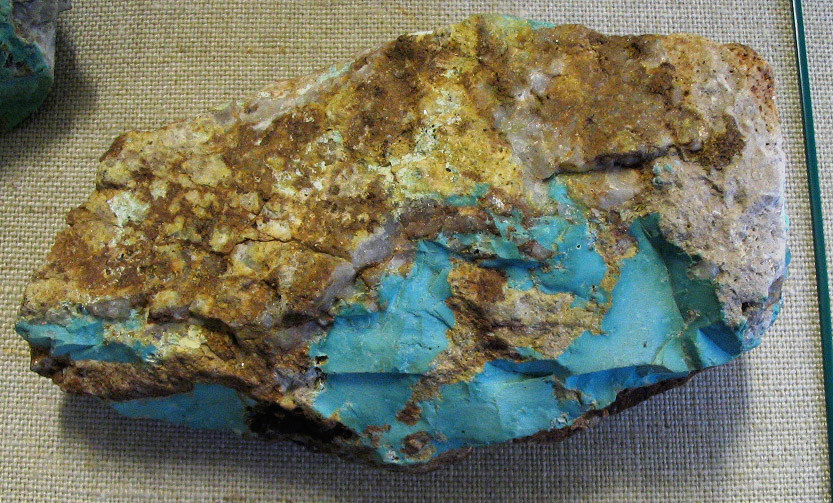
Mission–Sierrita district
The Mission district in southeastern Arizona encloses a group of large open pit copper mines known as Mission, Sierrita and Twin Buttes. These are located 35 miles north of the Mexican border and lie west of Green Valley and 15 miles south of Tucson. The Sierrita mine has state’s largest mill capacity and produces copper, molybdenum and rhenium from ore averaging 0.26% Cu. The operating of the mine, Freeport McMoran, purchased the adjacent Twin Buttes mine which has 700 million tons of ore at an average grade of 0.43% Cu.
The nearby Mission mine produces copper, silver, zinc, molybdenum, lead, gold, tin, tungsten, fluorspar and cadmium. The deposit was discovered in 1953 by drilling through 200 feet of valley gravel. By 1961, a major open-pit mine was opened. The ore is reduced at the adjacent Pima mill and concentrator. The Mission mine produced 121 million pounds of copper in 2007.
Mineralization is skarn and copper porphyry with seams and disseminations of copper carbonates and sulfides in altered, complexly folded and faulted Paleozoic limestone and Triassic sediments and volcanics that were invaded by Laramide intrusives. A 2-mile-wide alteration halo was associated with mineralization. The bulk of replacement ore occurs in garnet and pyroxene tactite. The Mission mine includes the merged Mission, Pima and Eisenhower Mines in a single, large open pit. The ore averages about 0.7% Cu, 0.13 opt Ag and considerable by-product zinc, molybdenum and lead with very little gold.
Near the Helvetica property, another company, Augusta, filed a plan for the Rosemont project that is designed to produce 230 million pounds of copper per year. The Rosemont porphyry-skarn is reported to contain 543 million tons of ore at an average copper grade of 0.75% Cu although other sources suggest the deposit averages 0.47% Cu.
Morenci district
 |
Boulder of azurite, malachite, cuprite
and tenorite
|
Morenci is another of the many porphyry copper open pit mines in Arizona. At Morenci, quartz monzonite intruded limestone and shale to yield a very large ore deposit with chalcocite, pyrite, chalcopyrite, and sphalerite veins.
Supergene enrichment was the result of erosion, chemical weathering and mineralization. Low-grade primary chalcopyrite and pyrite mineralization was deposited. Erosion removed approximately 1.8 km of rocks overlying the deposit and shed detritus to the north, the deposit was preserved under 640 to 950 meters of volcanic rocks as a result of mid-Tertiary extension and volcanism.
Most of the supergene copper enrichment at Morenci appears to have been formed as a result of Basin and Range deformation 13 to 4 million years ago.
Oro Blanco district
The Oro Blanco district is located along the Arizona-Mexico border adjacent to the Buenos Aires National Wildlife Refuge, thus making this district dangerous to prospect. Geologically, the area is underlain by a series of sandstones, quartzites, conglomerates and shale with some intercalated volcanic rocks. These rocks (Cretaceous?) rest on an irregular surface of altered, coarse-grained, grayish diorite and are intruded by mafic and felsic dikes.
Mineralization includes (1) irregular quartz veins and lenses with spotty auriferous and argentiferous base metal sulfides and pyrite in fracture fillings, or as replacements along faults and at fault intersections. These show supergene enrichment of gold and silver. The host rocks are altered conglomerates and sandy sediments or volcanic tuffs with local disseminated pyrite. Most deposits are limited in extent and depth; (2) Flat to shallow-dipping zones of quartz veinlets and stringers locally containing gold and silver and minor base metal sulfides usually associated with strong pyritization. Host rocks are strongly fractured, sericitized volcanic tuffs; (3) Steeply-dipping, tabular to lenses and brecciated shear zones with fine native gold and silver associated with finely crystalline quartz and weak iron and manganese oxides in volcanic tuff; (4) Small gold placers in several dry stream beds derived from the weathering of the many small lode deposits; (5) minor manganese oxides; and, (6) uranium mineralization in fracture zones in volcanic tuffs. The gold deposits of the Oro Blanco district include three principal types: (1) sulfide-bearing quartz veins, (2) mineralized shear zones, and (3) mineralized bodies of country rock.
Workings included a significant lead-zinc-silver operation (Montana-Ruby Mine). This mine is located at the ghost town of Ruby, which is a persevered mining town requiring admission. and many small, operations and prospects; although a couple of the gold mines in the district many have significant potential including the Old Glory, Yellow Jacket and Phoenix. Other mines include the Oro Blanco, El Oro, Oro Fino, California, Das Amigos By 1914, 1,750 gold mines and prospects had been located in the district. Estimated and recorded lode production through 1972 included 909,000 tons of ore containing 150,000 ounces of gold, 4,600,000 ounces of silver, 30,500 tons of lead, 26,300 tons of zinc and 2,600 tons of copper. At least 1,000 ounces of gold and 200 ounces of silver were recovered from placers. Some sorted manganese ore was shipped.
The Yellow Jacket gold prospect lies 6 miles north of the Mexican border and adjacent to the Buenos Aires National Wildlife Refuge. The Yellow Jacket was discovered in 1874 on the Ostrich lode. The mine periodically operated until 1959 when it was re-timbered and sampled for geological resources and deemed uneconomic to mine at $35/ounce even though ore grades were reportedly high (Ring and Ring, undated).
More recent exploration by Transatlantic Resources identified a gold resource of 740,000 tons an average ore grade of 0.37 opt Au. The prospect occurs on a series of quartz veins in a 30 to 50 foot wide shear zone. The veins range from 2- to 30-feet thick and have disseminated gold-bearing sulfides and uncommon base metal sulfides. The shear strikes northwest and dips steeply northeasterly. The wall rock consists of welded tuff (Jurassic) cut by rhyolite dikes.
The Yellow Jacket (section 21, T22S, R10E) sits adjacent and southeast of the Phoenix mine, which contains additional high-grade ore (reported to average 0.47 opt Au). Gold resources for the Yellow Jacket mine include 5.3 million tons. The resource includes 740,000 tons of measured resources at an average grade of 0.37 opt Au (274,000 contained ounces), 560,000 tons of indicated resources at 0.25 opt Au (140,000 ounces) and 4 million tons of inferred resources at 0.15 opt Au (774,000 ounces) for a total resource of 1,548,000 contained ounces of gold along with 527,000 ounces of silver. The Yellow Jacket produced 126,500 ounces during its early history and the nearby Old Glory mine was estimated to have produced 26,000 ounces prior to 1914. Based on the number of prospects and the identified resources in this district, it should be considered a priority exploration project after the border is secured.
Patagonia district
The Hermosa deposit was discovered in 1879. Some production occurred on neighboring properties including the Trench mine between 1939 and 1964. The Hermosa property within the Patagonia mountains in southeastern Arizona has drilled proven and probable reserves of 145 million ounces of silver and 7.2 billion pounds of manganese with inferred resources of 50 million ounces of silver and 1.2 billion pounds of manganese.
The deposit is located in a series of Cretaceous ash flow tuffs and breccias deposited on the Permian Concha Limestone and dolomites and sandstones of the Scherrer Formation. The ore is located within epiclastic sandstone at the apex of a doubly plunging anticline. Faulting likely supplies the mineralizing fluids which migrated to the anticline apex.
Ray District
The Ray mine, situated halfway between Hayden and Miami, began as underground mine prior to 1911 and yielded an estimated 4.5 million tons of copper. The operation was converted to open pit in 1955. Published reserves (1992) included 1.1 billion tons of ore averaging 0.6% Cu. The geology is complicated by faulting, host rock variation, two episodes of tilting, complicated enrichment history and hypogene and supergene alteration. The mineralization is controlled by rock type, faulting and enrichment. Mineralization was found in a variety of Precambrian rocks and in Laramide igneous intrusives. The mine yielded 229 million pounds of copper in 2007.
.JPG) |
The author stands next to a monster truck in front of the Ray open pit
mine. Every red neck would give his ... to have a monster
truck with tires like these - including me!
|
San Francisco (Oatman) district
In 1863, local Indians showed samples of gold-bearing quartz to John Moss, an army officer stationed at nearby Fort Mohave. These samples were reportedly taken from a vein in the northwestern portion of the Black Mountains, which later became known as the Moss vein (Hausel, 2013). About 12,000 ounces of gold were mined from the vein in the following year (1864) during the Civil War. A camp named Silver City was established about 1.5 miles south of the Moss vein on Silver Creek and a mill designed to use water from a spring in an otherwise dry drainage. A second mill was later constructed at Hardyville (renamed Bullhead City) on the Colorado River seven miles to the northwest. In 1866, war broke out between the gold prospectors and Hualapai Indians resulting in termination of mining operations: little prospecting took place over the next few decades until the beginning of the 20th century.
In 1900, another mineralized vein was discovered south of the Moss vein and named the Gold Road vein. In the following year (1901), gold was found in another vein further south at what became known as the Tom Reed. Following this discovery, a town known as Vivian was established in 1902.
%2B-%2BCopy.JPG) |
| The Road Gold vein (photo by the author) |
A sample from the Gold Road sparked a rush when a prospector collected vein material from an ore shoot that assayed 40 ounces of gold to the ton! In 1906, rich ore was also intersected in the Tip Top and Ben Harrison ore shoots on the Tom Reed vein; and in 1908, the town of Vivian changed its name to Oatman. Reports suggest Oatman grew to a population of 10,000 prior to declining to a few hundred residents by the mid-1920s.
The lode deposits are classified as epithermal veins that precipitated from hot hydrothermal fluids and hot springs rich in silica and carbonate. Precipitation of silica resulted in portions of veins forming resistant hard outcrops resulting in local linear ridges. Elsewhere, permeable fractures were flooded by soft carbonate (calcite) and rapid erosion of these produced linear depressions often buried by adjacent rock slump.
The veins were prospected for rich ore shoots. A group of shoots discovered along the Tom Reed vein included the Big Jim, Aztec and United Eastern ore bodies. A hidden (blind) shoot (Tip Top) yielded 580,000 ounces of gold. This shoot was mined under the town of Oatman until exhausted in 1924. Gold prices prior to 1924 were under $21 per ounce which suggests any unmined, low-grade gold in this so-called ‘exhausted’ shoot might should be recoverable at today’s gold prices. The discovery of rich ‘blind deposits’ in the district suggests similar hidden ore bodies are likely to occur elsewhere.
Over the years, a group of mines periodically operated and closed until all gold mines were closed by the War Minerals Board in 1942. Many of these properties were making a profit at $33.85/ounce. Some mines reopened after the war, but many did not and likely are profitable at today’s prices.
Some veins, such as the upper level of the Gold Road, are simple tabular bodies with sharp wall rock contacts. But most consist of stringer gold-quartz-calcite ore that cut blocks of silicified latite. Other veins consist entirely of reticulating stringer veins that traverse the country rock. This latter type is typical of portions of the Gold Dust vein. When stringer veins are sufficiently abundant, the country rock often is minable if gold contents of the stringers are sufficiently high. Compound veins with two or more veins of solid quartz and calcite separated by country rock are common.
Some ore shoots had good lengths and widths such as the Big Jim-Aztec shoot which had a maximum width of 35 feet. Ore bodies at the Black Eagle and Telluride mines were narrow on the Tom Reed vein, but the principal ore body on the Tom Reed vein mined at the United Eastern shaft had a width of 48 feet.
Gold and silver content decreased at depth. At the United Eastern, the grade dropped from more than 1 opt to less than 0.5 opt in gold (Au) at 800 feet. The Big Jim-Gray Eagle ore shoot averaged 0.95 opt Au above the 600-foot-level but decreased to less than 0.3 opt Au below this level. Similar abrupt changes were noted elsewhere. Ore bodies at the United Eastern, Tip Top and Ben Harrison all ended at nearly at the same depth. Ore shoots extended a thousand feet or more at depth in the eastern portion of the district, but in the western portion of the district, ore shoots were shallow and only a few hundred feet deep. The Gold Road, Tom Reed and Moss veins all had distinct outcrops. These were distinct not only because of silicification, but also because of iron and manganese that produced reddish- to black-stained rock.
Crushing and panning gypsum and quartz from some veins yielded tiny gold flakes. In the San Francisco and nearby Union Pass district, calcite stained by iron or manganese was sometimes mineralized. A sample of calcite from the Pioneer vein assayed 0.16 opt Au, while unstained calcite yielded no detectable gold. Pyrite is uncommon, but where found sometimes carries gold. A sample of pyrite from the Moss vein reportedly assayed 10.8 opt Au and 30.16 opt Ag. Cavities in the sample had visible gold in limonite. Water was lacking in most mines with the exception of the Aztec, Gold Road, and the United Eastern, where water was pumped from the lower workings.
Gold placers were very limited due to lack of active streams and tiny grain size of gold. Even so, placers were reported at various localities along Silver Creek and in tributaries that drain the Times Porphyry near Mt Hardy in the vicinity of Times Gulch. In the drainage below the Pioneer mine flakes of detrital gold were recovered from panned concentrates. Nearly all of the gold was found within three feet of bedrock. Some placer gold was also found below the Moss mine where the vein contained coarse gold. Overall, placer gold was minor and gravels were low grade.
The San Francisco district lies along the western flank of the Black Mountains of Mohave County in extreme western Arizona. The Black Mountains also enclose the Virginia, Pilgrim and Union Pass (Katherine) districts. The Black Mountains form a low-lying desert range 100 miles long by 20 miles wide that parallels the Colorado River to the west. The highest peaks in the range reach heights of only 5,000 feet: past temperature extremes at nearby Bullhead City and Needles to the west (600 feet elevation) reported a record low of 23oF and record high of 126oF with average annual precipitation of 7 inches. Kingman (3,300 feet above sea level) to the northeast reported temperature extremes of 6oF and 111oF with annual precipitation of 10 inches. Oatman (2,000 feet elevation) lies in the center of the Black Mountains and has annual precipitation of only 6.4 inches compared to a national average of 38.7 inches. In this hot, dry, desert; detrital gold may be found near many lodes, but water is as difficult to find as an honest Congressman.
 |
A book designed to assist prospectors in mineral and rock identification
|
By accessing either Flash Earth or Google Earth and searching for ‘Oatman Arizona’ bleached mine tailings will be seen both north and south of Oatman. These were part of the United Eastern (north) and Ben Harrison (south) mine operations along the northwest-striking Tom Reed vein. While viewing aerial photography around Oatman many mines, prospects, gopher holes, veins, fractures, lineaments and faults along with some clay alteration will be visible. Try to count all of the mines and prospects in the region before going cross-eyed. I counted 85 mines and prospects before I gave up, and this didn’t even include veins, trenches and countless gopher holes.
The majority of the lodes in the district are linear, fracture-filling veins in faults traceable on the surface for several hundred to a few thousand feet. Each vein typically has several prospect pits, trenches and one or more mines. The Pioneer vein for example, shows a distinct northwesterly-trending, 4,600-foot long vein (with vein splits) that was prospected by trenches and some mine shafts. The veins all have trace gold and silver along much of their length with periodic secondary enriched zones. It is the enriched zones (ore shoots) that are sought by prospectors presently, as well as in the past.
Some supergene enrichment occurred in veins of this district. In this process, poorly mineralized veins were enriched by redistribution of the metal content. This is a near surface phenomenon requiring meteoric water and chemical weathering to oxidize primary (hypogene) ore. Descending meteoric waters can dissolve some gold and transport the fluid through vein fractures until the gold re-precipitates at depth. Gold dissolution likely was a result by dissolved salts in meteoric water reacting with manganese oxides during weathering (manganese oxides coat large parts of the veins in the district). Gold then precipitated at depth when the meteoric water reacted with pyrite, carbonate, and/or groundwater. The supergene enrichment in such veins is evident by dramatic changes in ore grades at depth and by distinct differences of the gold-silver ratios of the precious metal in secondary supergene enriched zones compared to the primary hypogene ore.
Reported ore grades suggest some shoots averaged 0.58 opt Au and 0.17 opt Ag. The veins are described as sulfide-poor veins with bands of andularia (low temperature variety of potassium feldspar), quartz and calcite. Some contain crustiform chalcedonic quartz banded with calcite. Placer gold is limited due to a lack of perennial streams.
Gold Road Mine (center of section 11, T19N, R 20 W). The Gold Road vein forms a distinct mineralized zone with stringer ore and banded crustiform, quartz-calcite in silicified latite with widths up to 100 feet, locally. The vein strikes N50ºW and dips 80º to 85º NE occupying a fault mostly in latite. At shallow depth, the Oatman Andesite forms the footwall of the vein while latite forms the hanging wall. Examination of aerial photos in this area suggests the Gold Road structure could be as much as 9,300 feet long with buried segments.
Addwest Minerals reopened the mine in 1995 and outlined a 2.6 million ton gold resources at an average ore grade of 0.355 opt Au. In 1998, the mine closed due to depressed gold prices after producing 88,000 ounces of gold. The company now reports that it has 524,000 tons of reserves at an average grade of 0.23 opt Au. Addwest (Mohave Desert Minerals) reopened the mine in 2007 and poured its first gold bar in 2010.
%2Bvolcanic%2Bneck.JPG) |
Spectacular volcanic necks are seen when entering the Oatman area.
|
Two veins are described on the property known as the north and south veins separated by barren latite. Much past mining focused on northern vein, but stringers of both extend into the barren host rock that was considered too low grade to mine at $20/ounce. The mineralized zone is 6,435 feet long and continues to a depth of at least 680 feet.
Three ore bodies were described: Number 1 shaft ore body, Sharp ore body, and the Rice ore body. The largest ore shoot was found in the Number 1 shaft. This shoot was 900-feet-long extending from the surface to the 700-foot-level with a maximum width of 22 feet. About 600 feet to the southeast is the Sharp ore body, a blind ore shoot discovered underground starting above the 300-foot-level to the 500-foot-level. An extension of this shoot was mined between the 700- to 800-foot levels, while the vein in between ore shoots was purportedly too lean to mine at a profit. Less than 200 feet south of the #3 shaft was another blind ore deposit known as the Rice ore shoot discovered between the 300- and 500-foot-levels. This shoot had a strike length of about 400 feet.
 |
| The Gold Road mine in 2012. |
South of the number 3 shaft, vein outcrops are stained by iron and manganese oxides and small outcrops were mined along 1,500 feet of vein exposure, but in most cases, the ore did not extend below 100 feet. The vein narrows to less than 2.5 feet wide at its southernmost extent.
Moss mine (S/2 section 19 and N/2 section 30, T20N, R20W). The Moss mine is 6 miles northwest of Oatman: the vein has an N60oW-trend and 60o to 70oSW-dip. The mineralized structure is 45-feet-wide locally, and pinches and swells along strike. The structure ranges from 20- to 100-feet-wide with a wide mineralized zone and extensive stockworks and silicification. The Moss vein extends over a strike length of nearly a mile.
The vein is hosted by the Tertiary age Moss Quartz Monzonite Porphyry. The structure is open along strike and at depth. In the past, shafts were sunk 100- and 230-feet with 1,700-feet of drifts leading from the shafts.
The calcite-quartz vein occupies the hanging wall of a high-angle fault and is overlain by as much as 100-feet of low-grade mineralized stockworks and siliceous breccias classified as low-sulfide, adularia-sericite, epithermal vein typical of many near surface, hydrothermal veins. Such deposits are often related to paleo-hot springs and shallow geothermal systems. The vein contains some fluorite.
Along the southern portion of the vein, a group of conjugate veins occur in the hanging wall that have similar trend. Much of the historical gold and silver production from the vein was from conjugate veins.
In recent years, Patriot Gold Corporation identified auriferous veins unrelated to the primary vein that included the Discovery and Ruth veins. One hole drilled in these discoveries intersected a 5-foot section averaging 0.5 opt Au.
Using a 0.01 opt cutoff grade, the Northern Miner reported that the Moss deposit has 22.6 million measured and indicated tonnes grading 0.023 opt Au and 0.26 opt Ag plus 3.9 million inferred tonnes averaging 0.017 opt Au and 0.2 opt Ag. In total, the resources for this deposit include 603,000 ounces of gold and 6.6 million ounces of silver within 650 feet of the surface.
Identified gold and silver resources at the mine are reported to include 780,000 ounces of gold and 8,840,000 ounces silver (measured and indicated) with 216,000 ounces of gold and 2,517,000 ounces of silver as inferred resources. Ore grades range from 0.015 to 0.088 opt Au with high grade ore running 0.85 opt Au and 9 opt Ag, for a total resource of 996,000 ounces of gold and 11,357,000 of silver.
Holes drilled in the western extension of the vein were designed to test the extension of near surface quartz-carbonate stock work zones to the south. Multiple zones of stock work veining were encountered within 500 feet of the surface suggesting potential for widespread stock work mineralization to continue south. Eight additional drill holes demonstrated strong development of quartz-carbonate veins, breccias and stockworks that continue from the surface to at least 650 feet deep. Read more about Oatman at the Mining Journal.
Gold Basin District
The Gold Basin placers begin along he eastern edge of the White Hills and extend east to Hualapai Wash in Mohave County of northwestern Arizona (T28 and 29N, R17 and 18W). The area lies south of Lake Mead, the Lake Mead Recreation area, and the Colorado River. The nearest communities are Meadview (36o00’00”N; 114o04’00”) and Dolan Springs (35o35’25”N; 114o16’25”W). Dolan Springs is the nearest community with the basic supplies for prospectors - such as food and gas. Due to the large number of retirees and snowbirds settling in the region, each community is surrounded by extensive suburbs.
The gold placers are all dry placers in the desert, and these have detrital gravels that are only 1 to 5 feet thick that mostly lie on hard, false, bedrock of consolidated gravel cemented by caliche. The overlying gold-bearing gravels are weakly mineralized, and have considerable black sand and quartz with rock fragments of schist and gneiss eroded from the Precambrian terrain in the White Hills. The gold content of the placers is poor and may only be 0.03 to 0.04 ounce per cubic yard at best; while the underlying consolidated gravel remains unexplored. Gold nuggets are rare. Some nuggets up to an ounce have been found with the largest known nuggets being only 4 to 5 ounces in weight (Nevada Outback Gems website). Much of the area prospected in Gold Basin is part of the White Mountains alluvial fan that extends from the eastern flank of the uplifted White Hills to Haulapai Wash to the east. The fan covers a surface area of 6 miles by 5 miles. One can access the area by driving northward on the Pierce-Ferry highway (Road 25) through Dolan Springs.
Lode gold was discovered in quartz veins hosted by Precambrian rock in the 1870s. Placer gold derived from the veins was not found until the Great Depression. In 1932, W. E. Dunlop found gold in the dry gravel which attracted others to the area. The amount of gold recovered by the prospectors was minor and experienced miners only made about $1 per day (1933 wages). The total amount of reported gold recovered from the Gold Basin placers is only 415 ounces produced during the period of 1934-49. It is likely considerable more gold was recovered, but not reported. Even so, it also suggests the placers are small and very low grade. The amount of gold produced during the second world war would have been minor, and after 1949 to the present, could be considerably more. Unfortunately, production records are lacking.
A short time after the gold discovery, a large-scale dry-wash plant was installed in 1933 by S. C. Searles in section 29, T.29 N, R 18W (35°52'52"N; 114°13’54"W) along the Gold Basin Road in the White Elephant Wash southeast of Golden Rule Peak. The plant was equipped with a grizzly, trommel, screens, and a battery of twelve dry-washers and had a capacity of 20 cubic yards of gravel per hour. The amount of gold produced from this operation is unknown.
The gold-bearing gravels occur in arroyos and gulches at elevations of 3,300 to 2,900 feet. The gravels have medium-grained, angular schist and gneiss fragments with a minor amount of finely divided quartz. A small number of boulders are encountered that are generally less than 2 feet in diameter. The gold occurs as flour gold and less commonly as angular nuggets with some gold attached to black schist particles. The White Hills, which are made up of granitic, schistose, and volcanic rocks, contain many argentiferous and auriferous quartz veins that are the likely source for much of the Gold Basin gold (Wilson, 1981).
The gold placers have erratically distributed gold. In addition to dry placer mining, there is considerable prospecting with metal detectors. Some find gold, while others have found a bonus of meteorite fragments (Nevada Outback Gems website).
Superior
Superior Arizona is surrounded by porphyry copper mines including the Magma mines sitting on the edge of town. A major, hidden copper-molybdenum deposit was recently discovered in this district known as Resolution. Resolution was drilled and results indicate that the deep deposit has a minimum resource of 1.34 billion tons of ore averaging 1.51% Cu and 0.04 % Mo with gold and silver. The deposit is scheduled for production by 2020 and is located 3 miles east of the town of Superior. The deposit was discovered by drilling which interested mineralization at more than 4000 feet deep. One has to wonder how many similar deposits to Resolution occur in the states porphyry districts - probably several! When developed, the mine with its huge size and high grades could become Arizona’s largest mine. The property is operated by a Rio Tinto-BHP joint venture.
Tombstone district
 |
| Taxi service in Tombstone, Arizona (photo by the author) |
The Tombstone district in extreme southeastern Arizona was primarily a silver district. From 1879 to 1932, >30 million ounces of silver, 36 million pounds of lead and >250,000 ounces of gold were mined with copper, zinc and manganese. Mines included the Lucky Cuss, Bunker Hill, Herschell, Empire, Comet, Contention, Emerald, Grand Central, Ingersol, Luck Sure, Oregon, Old Guard, Prompter, Silver Plume, State of Maine, Toughtnut, Tribute and West Side. The ore was found as silver-lead ore and silver tellurides in (1) irregular replacements in the Naco Limestone along fissures and crests of anticlines, and (2) in altered porphyry dikes.
Rich bonanza ores were associated with tellurides, particularly the mineral hessite. Reported ore and gangue minerals included hematite, limonite, cerussite, cerargyite (AgCl) (known as horn silver), native gold, native silver, native copper, argentiferous galena, sphalerite, pyrite, alabandite (MnS), malachite, chrysocolla, psilomelane, tetrahedrite [(Cu,Fe)12Sb4S13], hessite (Ag2Te) and wulfenite (PbMoO4) (Wilson and others, 1969; Williams, 1980).
 |
Inside the Good Enough mine dug into limestones of the Bisbee
Formation. Photo by the author. |
The main structure is folded Paleozoic strata intruded by a porphyry dike. Mineralization occurs in quartz and in vertical joints particularly along the edge of the dike, in limestone as replacement deposits and in breccia, and as bedded deposits and fissure veins (Kemp, 1893). Many of the mines are located along the south end of Tombstone and northeast of Ajax Hill in Tombstone Hills.
The Emerald mine enclosed one of the largest ore bodies in the district. The nearby Silver Plume shaft was located 1000 feet southwest of the Emerald where mineralization was hosted by the Abrigo Limestone and Bolsa Quartzite and consisted of partially oxidized base metal sulfides with some wulfenite and horn silver in fault breccia. Ore control was related to a steeply dipping, north-south dike-fissure zone. The ore zone is 1,100 feet long and 10 feet wide. The Emerald shaft as sunk to a depth of 840 feet and the Silver Plume to 788 feet. Underground workings did not reach the limit of the ore. Work was discontinued because of flooding: the pumps were unable to handle the water influx below the water table. Read more about Tombstone at the Mining Journal.
Turquoise (Gleeson, Pearce) District
Copper was discovered 20 miles north of Bisbee and 15 miles east of Tombstone and a mining camp known as Turquoise was established in 1890 with a nearby town of Courtland, which now sits in the center of the district. Four years later, gold and silver was found on the Commonwealth property to the north and the town of was Pearce was established. Then in 1895, a prospector named John Gleeson, prospecting south of Turquoise Ridge discovered copper and opened the Copper Belle mine and the town of Gleeson was established. Mines in this district continued to operate until copper prices dropped resulting in mine closures in the 1930s. In the southeastern Dragoon Mountains, ridges rise 900 to 1,200 feet above adjacent plains (Hausel, 2013).
 |
Stockworks breccia at the Pearce gold-silver mine.
Photo by the Author (read more at the Mining Journal)
|
The geology suggests this area has good potential for discovery of hidden gold and base metal deposits. A variety of mineral deposits have already been identified in a broad, north-south, regional trend. Some of the more significant deposits include the Commonwealth silver and gold deposit at the north end of the district. To the south, two gold deposits of interest include Mexican Hat and Gold Coin.
Notable deposits include gold, silver and or copper prospects at Pearce, Courtland, Gleeson, Commonwealth, Mexican Hat Mountain volcanic-hosted gold mineralization (Tertiary) and the Gold Coin sedimentary-hosted gold project (Tertiary). Turquoise Ridge to the north is separated from the Gleeson Ridge to the south by a narrow gulch, Mexican Hat Mountain lies a short distance north of Turquoise Ridge. The ridges rise 900 to 1,200 feet above the adjacent plains. Quartz monzonite intrudes Paleozoic and older rocks, and granite cuts quartz monzonite and invades Cretaceous rocks.
Reported mineralization includes: (1) Irregular cupriferous blanket and replacement deposits where quartzite and limestone (Cambrian Bolsa Quartzite and Abrigo Limestone) have been thrust over Carboniferous limestone. (2) Irregular, tabular, pyritic lenses in Carboniferous limestone along a contact with quartz monzonite. (3) Manganese, lead, zinc, silver and minor copper and gold in irregular deposits associated with fault and fracture intersections in Pennsylvanian-Permian Naco Group limestones; (4) Near-surface turquoise in stringers in altered granite and quartzite; (5) Spotty base metals with gold and silver in veins in intrusive rocks; (6) Disseminated gold in Tertiary rhyolite and breccia; and (7) Structurally-controlled disseminated gold in faults and breccias in sedimentary rocks. At least 887,000 tons of base metal ore and 250 tons of manganese ore were produced in the past with some turquoise and considerable quartzite for smelter flux.
Two interesting occurrences in the district are epithermal gold deposits. Epithermal gold was identified in a mineralized structure 15 to 50 feet wide and 2,000 feet long at Mexican Hat Mountain in the central part of the district. The gold is described as free gold on fractures accompanied by hematite and limonite in Tertiary rhyolite and rhyolite breccia. In 1990, Placer Dome and Oneida Resources reported a geologic resource in six mineralized zones to include 10.3 million tons of ore at an average grade of 0.035 opt Au (362,000 ounces of contained gold).
In a press release on January 22nd, 2012 it stated that Auracle Resources Ltd drilled 5 holes at Mexican Hat. The gold mineralization was reported to occur in extensively fractured volcanic rock with abundant limonite/hematite alteration and in areas of pervasive limonite/hematite (gossan) within the volcanic hosts. The rocks are highly fractured making drilling difficult.
Drill Hole Results – Mexican Hat
________________________________________________________________________
Hole# From(ft.) To(ft.) Intercept(ft.) Grams/Tonne(Au) _______________________________________________________________________
MH11-001 267 305 38 1.75
337 381 44 2.16
MH11-002 154 182 28 2.49
273.2 349 66 4.19
397 406.8 9.8 2.53
MH11-003 200.8 215.5 14.7 138.30
MH11-004 53.15 125 71. 85 0.41
170.9 194 23.1 0.70
170.9 194 23.1 0.70
471 496 25 1.34
MH11-007 50 70 20 13.40
A similar deposit south of Mexican Hat is known as the Gold Coin. This is also an epithermal deposit, but is instead hosted by sedimentary rocks. Secova geologists collected composite chip samples from trenches that included 45 feet of 0.11 opt Au (with an enclosed 20 foot zone averaging of 0.16 opt Au): the samples began and ended in mineralization. In another trench a composite chip sample yielded 60 feet of 0.06 opt Au (with an enclosed zone of 15 feet of 0.2 opt) (Hausel, 2013b)
 |
| Visible gold in rhyolite at the Commonwealth mine. (Photo by the author). |
Soil geochemical anomalies showed strong signatures of gold, silver, arsenic and antimony. Combined geochemical and geophysical anomalies outline a north-northwest trending zone 3,000 feet long by 1000 feet wide with two other anomalies of 1000 feet by 1500 feet and 2800 feet by 750 feet. The area is covered by a thin veneer of soil making outcrop sampling difficult. Brecciated limestone in the mineralized zone has variable clay alteration and moderate to locally strong silicate veining with hematite veinlets. It is assumed that Tertiary gold-enriched fluids were emplaced along northward-trending structures and along sub vertical to high-angle normal faults. Some Carboniferous limestones have extensive jasperoid alteration and strong limestone decalcification (Moore, 2010).
The Gleeson placers are dry placers with fine gold to medium size nuggets. The gulch west of the Copper Belle Mine has some coarse gold.
 |
Vein exposed on surface east of the Commonwealth silver-gold mine.
Photo by the author. |
The Johnson Camp mine is in the Little Dragoon Mountains about 65 miles east of Tucson. The Mountains consist of a core of Precambrian granite and schist unconformably overlain by Precambrian metasedimentary rocks and Phanerozoic sedimentary rocks. The mine began production in 2008 and Nord Resources planned to reach full production of 25 million pounds of copper/year by the end of 2009. Total proven and probable reserves are reported to be 73.4 million tons of ore at an average grade of 0.34% Cu (492 contained pounds of copper).
Weaver (Rich Hill) District
The Weaver district at the southwestern margin of the Weaver Mountains, is 10 to 12 miles north of Wickenburg and 6 miles east of Congress. Yarnell is 2 to 3 miles to the northwest.
Following discovery of gold in the district, three towns sprang up to support the gold mining and all three developed a notorious personalities. According to the Prescott newspaper in 1892, the residents like to “drink blood, eat fried rattlesnakes and fight mountain lions”.
Octave, Stanton and Weaver were established following discovery of gold on Rich Hill folioed by gold discoveries in Antelope Creek and Weaver Creek in 1863. The discovery occurred when a group of men camped along Antelope creek and their guide abandoned them and one member took off chasing a runaway burro. This individual tripped over a pile of gold nuggets described “as big as potatoes” and thus became known as the Potato Patch. A short time later, gold was found on top of Antelope Hill. According to Pauline Weaver, the leader of the group, the gold was so common he popped out nuggets with his knife. That one acre of ground was later reported to yield a half million in gold (period prices)!
Using a 1863 gold price ($31.23), a half million dollars was equivalent to more than 16,000 ounces. A gold rush followed and Antelope Station grew to 3,500 people. The town, was later renamed Stanton (34°9'54"N; 112°43'48"W), received its name from Chuck Stanton, a notorious prospector who was accused of murdering several people in his quest to control the town and gold properties. Stanton was later killed by a Mexican gunman. The town of Stanton became known as a lawless town. By 1905, Stanton was turned over to the ghosts, but later partially restored with live people from the Lost Dutchman Mining Association, which set up a member’s trailer park at the townsite.
The nearby ghost town of Octave (34°8'31"N; 112°41’24”W) was built to the east. The town is also a ghost town with much of the former town removed after the second world war. A third town, Weaverville (34°9'18"N; 112°42’25”W) is now a ghost town originally named after Pauline Weaver. The location of the town is in the Weaver Creek drainage between Octave and Stanton. Weaverville was renamed Weaver. The town at one time was under the control of bandits led by Francisco Vega.
The Weaver Mountains are formed of granite, diorite, and schist, intruded by aplite, pegmatite and mafic dikes, locally covered by lava. Mesothermal gold-bearing quartz-pyrite-galena veins occur in gently north-northwestward dipping fault zones.
The three largest lode producers in the region were the Congress-Niagara-Queen mine in the adjacent Date Creek district which produced 700,000 tonnes of ore averaging 0.62 opt Au, the Octave (800,000 tonnes at 0.26 opt Au), followed by the Alvardo mine within the Weaver district. Several other mines exposed similar veins including Beehive, Commodore, Jerome, Leviathon, Minica, Rincon, Yarnell and others. These exhibit shallow 15- to 50oNW-dipping thin quartz veins in shears and thrusts in and along diorite to rhyolite dikes within Precambrian granite and granodiorite (locally gneissic). The veins are oxidized near the surface with minor pyrite and lessor galena, chalcopyrite and sphalerite with minor silver. The district was the second largest gold-silver vein producer in Arizona after Oatman.
The Weaver and Rich Hill placers cover an area of approximately 5 by 8 miles and gold placers are scattered all over the hill sides and valleys in the area around Antelope and Weaver gulches, 6 to 8 miles east of Congress Junction. The more productive placers occur in the northern half of the area. On Rich Hill, gold is found on bedrock where boulders and thin layers of clay are found. In the drainages below Rich Hill, iron stained gravel and sand is up to more than 10 feet thick and contains abundant subangular boulders 2 to 6 feet in diameter. The WeaverMountains rise to more than 5,000 feet above sea level and more than 2,000 feet above the adjacent desert plain to the south. Rich Hill attains an elevation of 5,200 feet above sea level between the deeply eroded canyons of Antelope Creek on the west and Weaver Creek on the east. Since the higher portions of the Weaver Mountains receive at least 18 inches of rainfall per year, the two south-flowing creeks often have some water in their upper courses and are subject to torrential floods during rainy seasons. The flash floods often dislodge gold from the nearby veins to recharge the gold placers. An estimated 110,000 ounces of gold were recovered from the area.
In the early 1860s, Indians trading at LaPaz on the Colorado River reported finding gold to the east. One was persuaded to guide a party to the area that included Capt. Pauline Weaver, Maj. A. H. Peeples, and others, camped at the base of Rich Hill, after their guide had deserted them on the desert north of Wickenburg. A Mexican in the group, while looking for their strayed animals, discovered loose gold nuggets on top of Rich Hill. This discovery led to placers along Weaver and Antelope creeks.
This entire area was subjected to a gold rush, and in five years, produced about $500,000. Gold found underneath boulders and in crevices of rocks on Rich Hill was easily gathered, but more effort was required for sluicing for gold. As much as $40,000 is said to have been taken from a certain acre, and the production of the whole area prior to 1883 was estimated at $1,000,000.
The value of known output from the Weaver and Rich Hill placers since 1900 has been approximately $150,000, of which $83,975 was recorded for the years 1905-31, and $62,049 for 1934-49.
Approximately fifty men were carrying on sluicing and rocking in this field during the winter of 1932-33, but their. number decreased to eighteen with the advent of summer. Because the gravels are mostly coarse and have been repeatedly worked, the average daily earnings were not more than 30 cents per man. Minor amounts of dry-washing have been carried on in the vicinity of Oro Fino Gulch, in the ·southern portion of the area.
The placer ground covers an area of approximately 8 by 5 miles. The most productive portions were in the northern half of this area and included about 10 acres on top of Rich Hill; portions of the sides of Rich Hill; channels and benches of Weaver, Antelope, and other washes; and gravel benches that lie between these washes.
 |
| The 8.71 ounce Ehrhart nugget found in 1931 at Rich Hill |
Rich Hill rises steeply for about 2,000 feet above the plain and is underlain by intensely jointed granite. It is cut by thin, lentIcular, quartz veins which carry pyrite, galena, and gold. The top of this mountain is a hilly mesa about ~8 mile long by % mile wide, that represents an erosional remnant of the elevated Weaver Mountain pediment. It includes several acres of broad, shallow basins and drainage channels whose granite floors are mantled by granite boulders and very thin, rusty, sandy soil. A few angular pebbles of quartz and hematite are locally present. The once-abundant placer gold in the shallow basins and drainage channels is proclaimed by numerous old workings that scoured every square foot of their surface.
Along washes and benches below Rich Hill, the placer material consists of iron-stained gravel and sand, up to 10 or more feet thick, together with abundant subangular boulders 2 to 6 feet in diameter. The fineness of the Rich Hill and Weaver placer gold is 910. On Rich Hill, one nugget worth $450, and three worth a total of $1,008 were found. The largest nugget found on upper Weaver Creek was worth $396, and that two chunks of quartz contained $450. In the spring of 1931, a large nugget (known as the Ehrhart nugget) was described with a general outline shape similar to a human molar approximately 53 mm across the widest portion of the roots, and 47 mm from the bottom of the 'root' to 'the crown.’ Several fragments of slightly iron-stained quartz remain in the center of the mass. The total weight is 270.90 grams: the nugget consists of 252.38 grams of metal, 18.52 grams of quartz and 22.71 grams of silver .
During the 1932-33 season, a few nuggets ranging up to more than 3 ounces each in weight were found along Weaver Creek. Two nuggets, each weighing more than 5 ounces, were found in upper Antelope Creek. Away from the mountains, the coarse gold becomes progressively rare.
Wickenburg District
According to historical accounts, a prospector by the name of Henry Wickenburg was searching for gold along the Hassayampa River (a dry river much of the year) when he spotted a dark, iron-stained, outcrop on a hill (Quartz Butte) to the west. On close examination, he found visible gold in outcrop and filed a claim for the vein in 1863.
Wickenburg’s initial samples assayed 6 ounces per ton gold. Instead of mining, he decided to sell ore to local prospectors for $15 per ton. The miners hauled ore to the Hassayampa River where the rock was processed in arrastras wherever water could be found in the intermittent stream. In 1866, Wickenburg sold his interest to the Vulture Mining Company and the company constructed a 40-stamp mill near the present town site of Wickenburg and gold was recovered from high-grade ore that ran 1.2 to 4.5 ounces per ton.
 |
| Lode vein at the Vulture mine |
Early mine development focused on the western portion of the vein. High-grade ore was hauled by wagon to the mill and high-grading occurred both in the mine, at the mill and on the haulage wagons. This apparently became a serious problem for the mine owners.
In 1868, the western extension of the vein was mined by a separate operation known as the Smith group which built the Smith mill 10 miles east of the mine to process their ore: this mill had 20 stamps. At least three mills were initially constructed because of divided property ownership in the area. The third mill was constructed 3 miles north of the Smith mill at Seymour. In 1870, it was reported 300 miners were employed by mine operations and Vulture City had about 500 residents.
When the mine reached the 240-foot level (240 feet deep), a rich pocket of gold was intersected where the vein swelled to 47 feet wide. This shoot produced ore that contained 7 to 12.5 ounces per ton gold. In 1872, the vein appeared to pinch out in the eastern portion of the mine and operations refocused on the western portion. In 1879, the Arizona Central Mining Company purchased the property and constructed a 16-mile long waterline from Wickenburg to the mine site and expanded mill operations with an 80-stamp mill. Mining continued on the western vein extension until the eastern vein extension was rediscovered at depth.
Nine years later (1888), the vein was again lost. The vein was cut by a fault known as the Talmadge Fault that sliced the vein on the 300-foot level and the vein had been down-dropped to an unknown depth. At the time, mining operations were restricted to the western portion of the vein above the fault and it wasn’t until 20 years later (1908) that a comprehensive geological study was conducted that led to the discovery of the vein offset. The mine reopened and ore was again processed to recover gold on amalgamation plates while tailings were stored for cyanide treatment. A new mill was constructed in 1910 that had 20 stamps with a capacity of 100 to 120 tons per day. Water wells were drilled. One intersected groundwater in a gravel lens beneath a lava flow at 400 feet deep. Another well was drilled to 1,000 feet before hitting water.
The mine operated until 1917 when the vein was again lost. This time it had been offset along a second fault (Astor Fault) on the 950-foot-level in the eastern portion of the mine. The Astor fault cut the vein also displacing it somewhere down dip.
Exploration for the offset vein began with the sinking of a 500-foot winze sunk from the 1050-foot-level. The vein offset was discovered on the 1,550-foot mine level and operations continued until the mine was closed by the War Production Board in 1942. At this time in history, the War Production Board closed all non-essential mines in the US to ensure maximum energy was directed towards the war effort. Many mines that were closed by the order never reopened, suggesting that at today’s gold prices, many of these likely have commercial ore.
 |
Glory Hole at the Vulture mine with ghost
town in background - photo by the author.
|
The Vulture mine sits at the southern edge of the Vulture Mountains 50 miles west-northwest of Phoenix. The basement (oldest exposed crustal rock) in this area is Proterozoic (2.5 to 0.6 billion year old) metamorphic and igneous rock (schist and gneiss) intruded by Cretaceous (145 to 65 million year old) granite and granodiorite that is unconformably overlain by lower to middle Miocene (23 to 5 million year old) volcanic (rhyolite and andesite) and sedimentary rocks. All of these have been tilted by rotational (normal) faulting such that the original bedding is now near-vertical to overturned. The Vulture vein is associated and related to the granite pluton.
The mineralized zone at the Vulture mine is fault controlled with the vein trending east-west nearly parallel to foliation with a dip of 45oN. The vein was traced 1,000 feet on the surface and is 32 feet wide on the surface. It is a complex mix of quartz and schist, such that mineralized quartz (about 6 feet thick) lies adjacent to footwall schist. The vein is overlain by chlorite schist followed by a large 30 to 50 foot thick quartz vein that includes low-grade white quartz and quartz with brecciated schist. The hanging wall is composed of chlorite schist and granite porphyry while the footwall is sericite schist. The vein was quarried on the surface in two, small, gossan-stained small open pits.
Gold mineralization occurs within and adjacent to a north-dipping quartz vein and quartz porphyry dike that extends eastward from the granite pluton. Gold is concentrated in quartz veins and in silicified and altered rock within and adjacent to the dike. The precious metal occurs as native gold or electrum and is also associated with pyrite, galena and minor chalcopyrite and sphalerite. There is a positive correlation between gold and secondary silica and sulfides. Granitic breccia clasts become progressively more common to the west in the vein. Where the vein extends into the granite pluton, it splits into smaller veins prior to pinching out.
 |
| Assay lab at the Vulture mine. Photo by the author. |
The geology suggests ore shoots occur en echelon in the vein. Another undeveloped shoot was proposed to occur further east and at greater depth that those mined in the past. In the area overlying this proposed ore shoot; surface rock exposures include Miocene volcanic tuffs and lavas which cover the older Proterozoic schists and gneisses. The metamorphic rocks are again found 3,000 feet further east where they show some evidence of mineralization. The faults which offset the Vulture vein are not exposed at the surface and are buried under gravel and lava.
Pervasive wall rock alteration adjacent to the vein resulted in replacement of feldspar and mafic (dark) minerals by sericite, hematite and clay. The gold was reported to be 760 to 780 fine. Production figures are incomplete. Available reports indicate the mine produced at least 340,000 ounces of gold and 260,000 ounces of silver from ore that had an overall average grade of 0.35 opt gold and 0.25 opt silver.
In recent years, there was an effort by preservationists to push the State of Arizona into purchasing the Vulture mine and ghost town and withdraw the property from mining. Such activities tend to set a dangerous precedent in letting government nationalize private property and control private land and businesses. Such activities lead to corruption and mining companies avoiding some states and regions. For now, Arizona’s Vulture mine appears to have weathered the effort to have the State of Arizona purchase private property and more recently, the property was optioned by a Canadian company: Source Gold Corporation. Read more about this mine and district at the Mining Journal.
Union Pass district
Union Pass to the northwest produced 128,000 ounces of gold and 313,000 ounces of silver from 1865 to 1942. The Virginia district to the north yielded 17,800 ounces of gold and 17,700 ounces of silver, with some copper and lead from 1907 to 1955. The Pilgrim district to the north produced 48,000 ounces of gold and 72,000 ounces of silver from 1929 to 1945, while the San Francisco (Oatman) district itself, contributed 2.2 million ounces of gold and 800,000 ounces of silver.
The Katherine mine was developed on a vein in sheared granite near the Colorado River. This vein had a width of >60 feet at the surface and pinched at depth. It was traced for and 1,700 feet along strike. The mine was developed to a depth of 900 feet.
Many mineralized faults in the district are poorly exposed and some are hidden under gravel. The veins are simple, being tabular bodies of quartz and calcite with well-defined walls, while others consist of several vein stringers separated by barren rock. These consist of quartz, calcite, andularia, fluorite, gold and silver.
Wallapai district
The Wallapai is located near the center of the Cerbat Mountains, which extend north of Kingman in western Arizona and enclose the Chloride, Mineral Park, Cerbat and Stockton camps. The Cerbat Mountains are an eastward-tilted fault-block of Precambrian metamorphic and igneous rock intruded by Tertiary granite porphyry. Mineralization consists of copper in shattered granite porphyry and lead-zinc veins with associated by-product gold and silver. The veins are superimposed upon and grouped symmetrically around the porphyry copper mineralization. Turquoise deposits formed in the supergene enriched porphyry cap. A late fault cuts both bedrock and alluvium at the western base of the range. This fault and surrounding alluvial blanket contains chrysocolla at the Emerald Isle copper deposit.
Yarnell district
The Yarnell lies along the southern edge of the town of Yarnell in the Weaver Mountains north of Phoenix. The district lies within Precambrian granodiorite. Mineralization occurs as gold in veins in the Yarnell fault. The gold grades are the highest in the vein within the fault and values decrease away from the fault. The grades and width of mineralization appear to decrease long strike but are open down dip.
CONCLUSIONS
Eastern Arizona has several important mines and known mineral deposits with potential for discovery of additional gold and copper resources in essentially every district. Areas of notable interest for gold are the Gleeson, Oro Blanco and Copper Creek districts. Western Arizona has many more primary gold deposits than eastern Arizona and there are a number of lode, placer and dry placer deposits that suggest several deposits likely remain hidden and undiscovered. Some notable deposits in western Arizona include the Vulture mine and Rich Hill within the Wickenburg district, the Katherine and Oatman properties in the San Francisco district, prospects in the Wallapai district, gold in Lost Basin district, and gold in the La Paz district within the Dome Rock Mountains, Plomosa Mountains and La Posa plain between these two mountain ranges. These will be discussed in a follow-up article on Arizona.
So how much is the mineral wealth in Arizona? The Arizona Department of Mines and Mineral Resources reported $7.6 billion in minerals were mined in 2007 – much of this wealth was from copper and precious metals. So what does government obtain from this? The answer is taxes and the state of Arizona gets jobs? It is very likely that more jobs and a greater tax base could be created by stabilizing the border with Mexico, creating incentives for exploration companies and gold prospectors to explore, and most of all, significantly cut taxes and government bureaucracy. All too often in natural resources, permitting is duplicated at the county, state and federal levels. For instance, while drilling for diamonds in Colorado a couple of years ago, a company I was consulting for was required to obtain the same permit (with different requirements) from three different government agencies. Without mining, we would fall back into the stone age. Stop, think! Is there anything around you that was not mined?
.JPG)